Deluge to take a pause in B.C. before next atmospheric river arrives

B.C. will see soaking rains wind down Sunday afternoon and evening, but there won't be a chance to catch much of a breather as the next atmospheric river is teeing up for arrival Tuesday morning.
British Columbia hasn't been able to catch much of a break in the two weeks since the epic rains that brought damaging and deadly flooding, mudslides and highway washouts. Two more atmospheric rivers took aim at the province in recent days, and with flood watches and warnings in effect, along with evacuation orders, yet a third is on its way early next week. For a look at what's left of the current system, and the next one gearing up, see below.
SUNDAY EVENING: RAIN WINDING DOWN, EVACUATION ORDER ISSUED
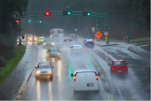
Down from its peak intensity, the latest intense Pacific frontal system was winding down its effects through the afternoon, though some areas may see some showers last into early Monday.
In all, people in the region will be tallying accumulative totals of 70-120 mm for Metro Vancouver, with heavier totals likely for areas near the mountains.
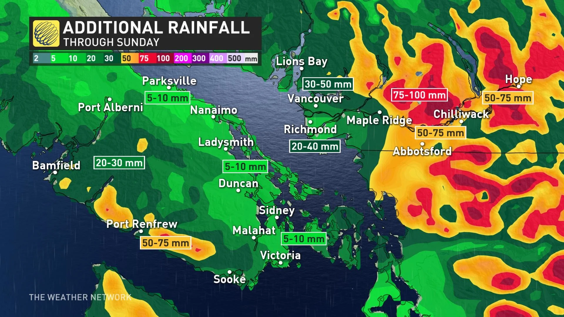
Given, how waterlogged the region already is, with limited prospects for being absorbed by the soil, the runoff from these prodigious downpours has nowhere to go but the region's already swollen rivers, making flooding and landslides a very real possibility.
A flood watch from the B.C. River Forecast Centre is in effect for most of the region's watersheds, gradually expanding as the rains fall. A full-fledged flood warning is in effect for the Coquihalla River above Alexander Creek.
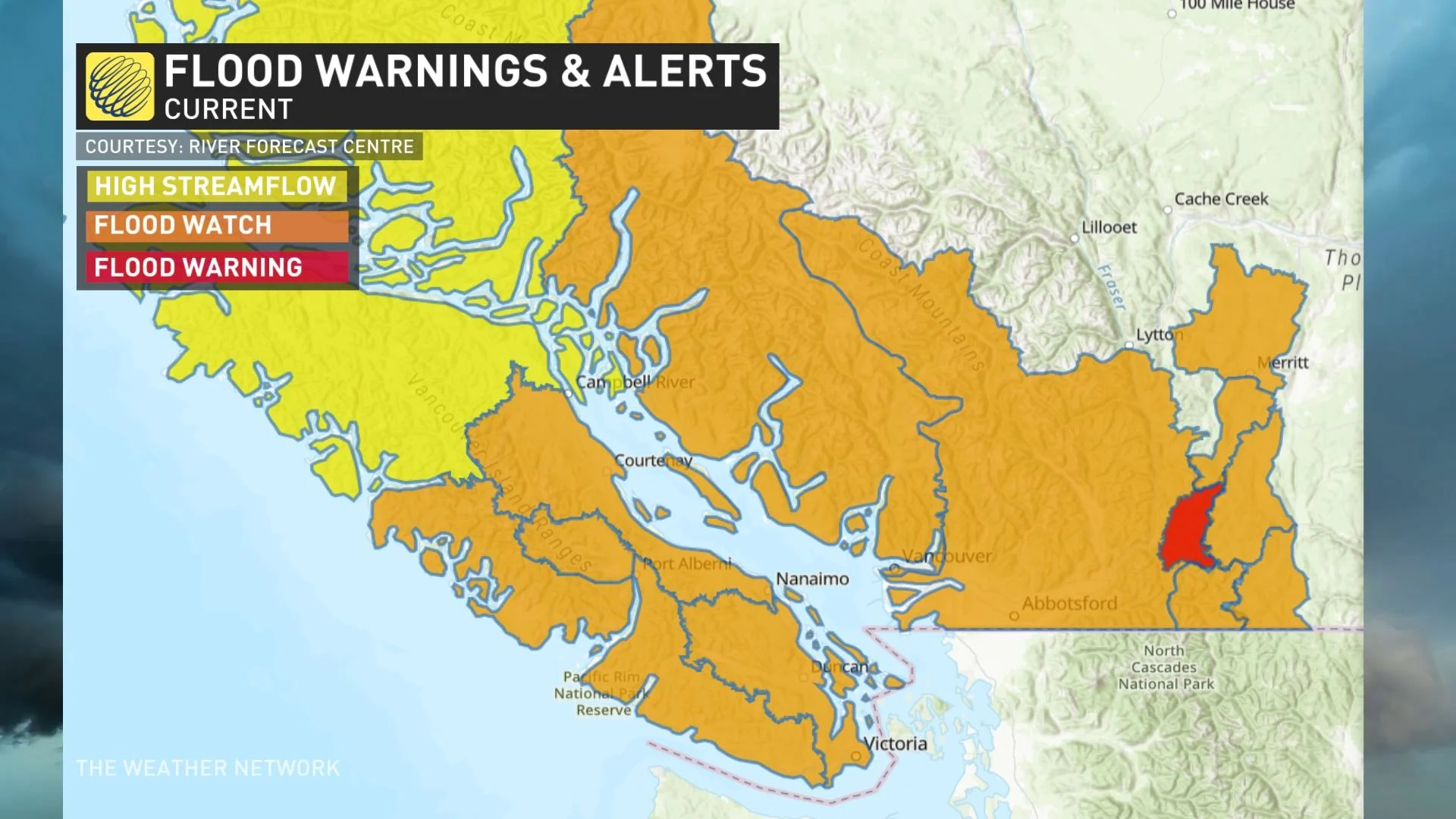
As well, the City of Abbotsford issued an evacuation order for people in areas of Huntingdon Village.
Before Saturday's deluges, the transport ministry pre-emptively closed Highway 3 between Hope and Princeton, and Highway 99 between Pemberton and Lillooet, and Highway 1 in the Fraser Canyon. Some highways were reopened, others remained closed Sunday afternoon.
WATCH BELOW: MORE B.C. FLOODING, CLOSURES AND EVACUATIONS FROM SECOND ATMOPHERIC RIVER
LONG RANGE: EXCESSIVE RAINFALL TOTALS WITH BACK-TO-BACK STORMS, AN END TO THE STORMY PATTERN IS IN SIGHT
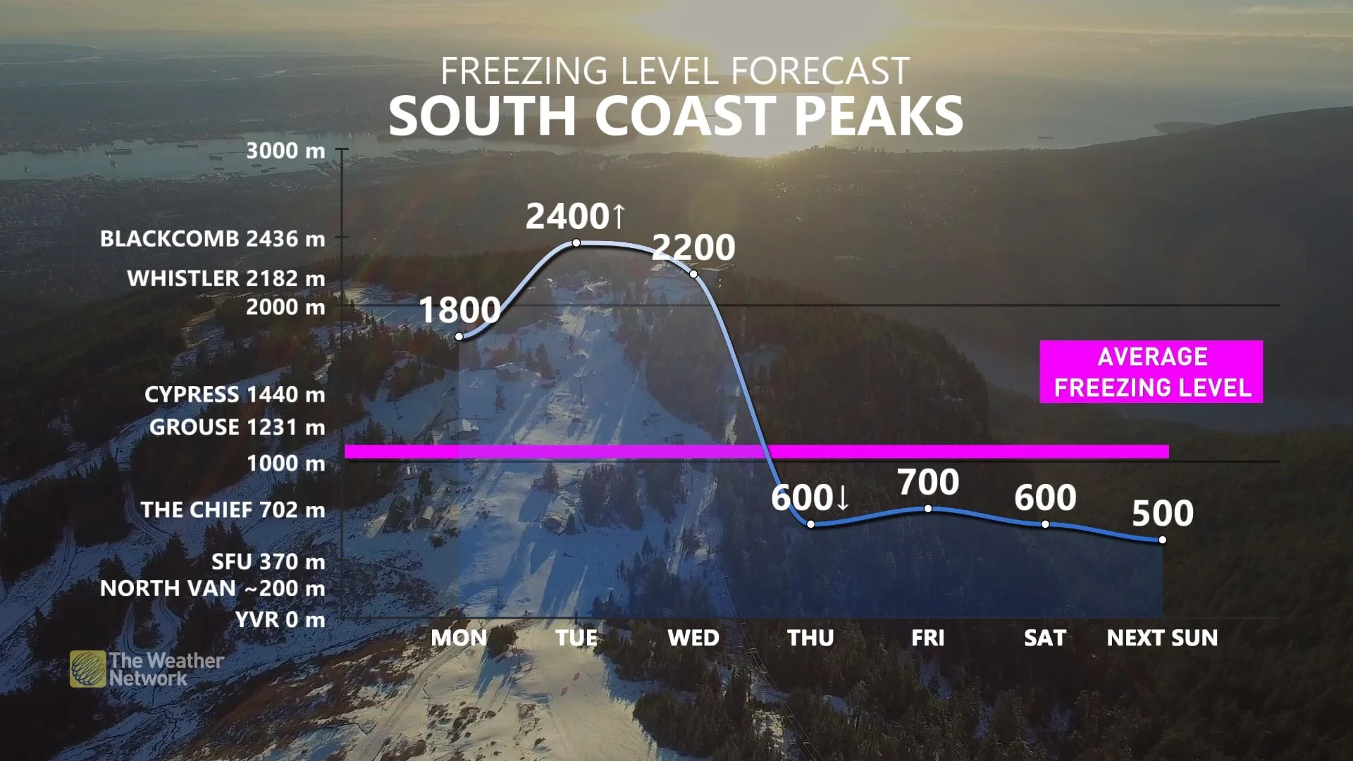
Monday will give some opportunity to dry out, but not much of one: Yet another potent system is expected early next week for Tuesday morning, lingering into Wednesday.
With the forthcoming atmospheric river, freezing levels early Tuesday morning will initially be lower than 2000 metres, so alpine snow will be on the table. They will, however, soar once again above 2000 metres and remain there through Wednesday. In any case, they remain high enough that snow that fell in recent weeks will continue to melt, adding to the runoff swelling the province's rivers.
However, there is some good news. The unrelenting stormy pattern breaks down as we head into late week -- from Thursday to Saturday. There will be no major systems to impact the region.
Check back as we continue to monitor the ongoing storm parade across British Columbia.