Alberta's first snowfall of the season may lead to hazardous travel

Break out the shovels and take care if you plan to travel across southern Alberta this weekend. Some spots could see hefty snowfall totals.
The first significant snowfall of the season for Alberta has begun over parts of southern sections including Calgary.
It is shaping up to be a memorable event for some as the system is overachieving in parts of the province. Snowfall warnings are in effect for areas along and near the foothills, with as much as 35 cm possible by the time all is said and done.
MUST SEE: Marvel at the Pillars of Creation in new breathtaking view from Webb
Snowfall will continue to pick up through late morning on Saturday. Heaviest snowfall along the southern foothills is likely by the evening hours. Accumulating snowfall will reach as far east as the QE2 through Sunday.
Amounts will be greatest over the higher elevations, especially with the help of upslope winds flowing up over the mountains and enhancing totals, which will continue throughout the day Saturday.
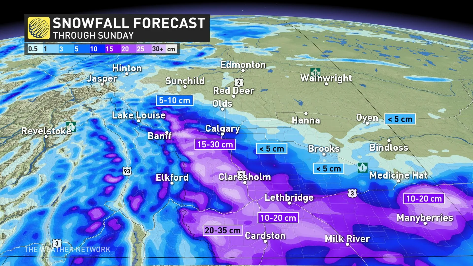
Calgary has been added to the snowfall warning, with over 10 cm already reported in the city, with more to come as it continues to quickly accumulate. Another 5-10 cm is expected by the time it subsides.
Heavy, wet snow accumulating on trees with remaining foliage may break branches, which could result in power disruptions.
The snow will gradually taper off into early Sunday morning. Total accumulations of 15-35 cm are anticipated.
READ MORE: Snow can spread and worsen the effects of pollutants in the environment
Other major cities along Highway 2 will likely see rain-snow showers as temperatures hover just above the freezing mark. These areas will likely pick up less than 5 cm through the entire event.
"Prepare for quickly changing and deteriorating travel conditions. Visibility may be suddenly reduced at times in heavy snow. Take frequent breaks and avoid strain when clearing snow," Environment and Climate Change Canada (ECCC) warns.
Depending on the timing of the storm and extent of cold air at the surface, we’re watching the potential that snowfall along the southern foothills could overperform and produce more snow than expected.
With this being one of the first major snowfalls of the season, it may challenge drivers or catch some motorists off guard.

Looking ahead, this system will herald a significant pattern change for Alberta. Wave goodbye to the summer-like warmth that’s bathed the region for so many weeks now.
Daytime high temperatures heading into next week will fall solidly on the cooler side of seasonal, with the mid-single-digits expected in Calgary through the end of the month.
DON’T MISS: It's Fall Farm season! We pick our favourites to visit from coast to coast
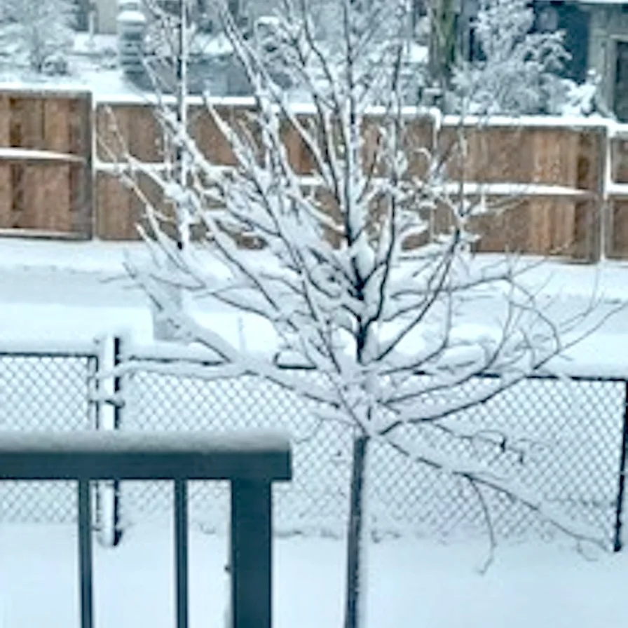
Thumbnail courtesy of Jay Nat, taken in Calgary, Alta.