Alberta: Snow, strong winds fuel Saturday avalanche threat

Strong winds are set to lash southwestern Alberta Saturday, coupled with heavy mountain snow in the forecast that will keep the avalanche threat level at high for several parks. We have details of where the danger level is high, and just how strong winds could get Saturday, below.
WEATHER HIGHLIGHTS:
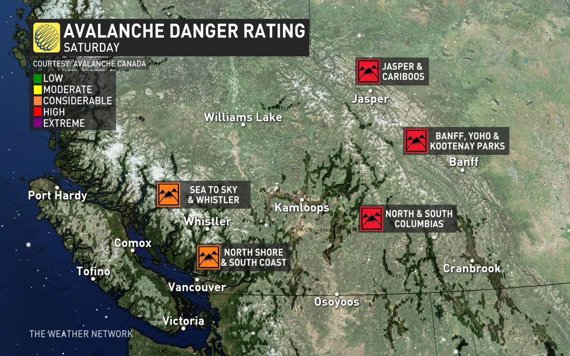
Avalanche danger is considerable to high in all major locales
Winds will strengthen Saturday afternoon potential for 100+ km/h gusts near the U.S. border
Latest avalanche information in your area
Stay up-to-date on the ALERTS in your area
AVALANCHE DANGER RAISED
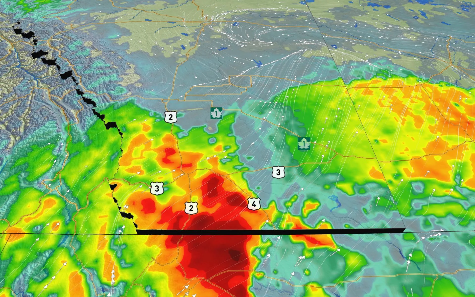
A combination of heavy snow that has fallen in the higher terrain of the Columbia and Rocky Mountains and the strong winds has raised the risk for possible avalanches this weekend. Heavy snowfall is expected in the foothills and could reach 20-40 cm at higher elevations.
Banff, Yoho and Kootenay, Jasper and Cariboos, North and South Columbias, Little Yoho and Glacier national parks are all at high and are forecasted to remain that way at least through Saturday. Jasper National Park is currently at a considerable risk.
"An intense winter storm is delivering heavy snowfall and strong winds. Widespread avalanche activity is expected. Avoid avalanche terrain," warns Avalanche Canada.
Avalanche Canada's rating for a high threat means there are "very dangerous avalanche conditions." Travel in avalanche terrain is not recommended due to the likelihood of natural and human-triggered avalanches. There could be large avalanches in many areas or very large avalanches in specific areas.
"The combination of wind and snow could elevate the avalanche dangers, so keep that in mind if you're planning on heading into the mountains over this weekend," adds The Weather Network's Kyle Brittain.
SATURDAY -- WINDS PICK UP AGAIN, COULD REACH 100 KM/H IN SOME AREAS
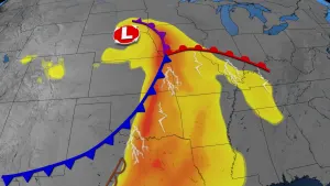
Another low-pressure system moving into Alberta Saturday has the potential to produce damaging gusts across southwestern areas, contributing to the avalanche risk.
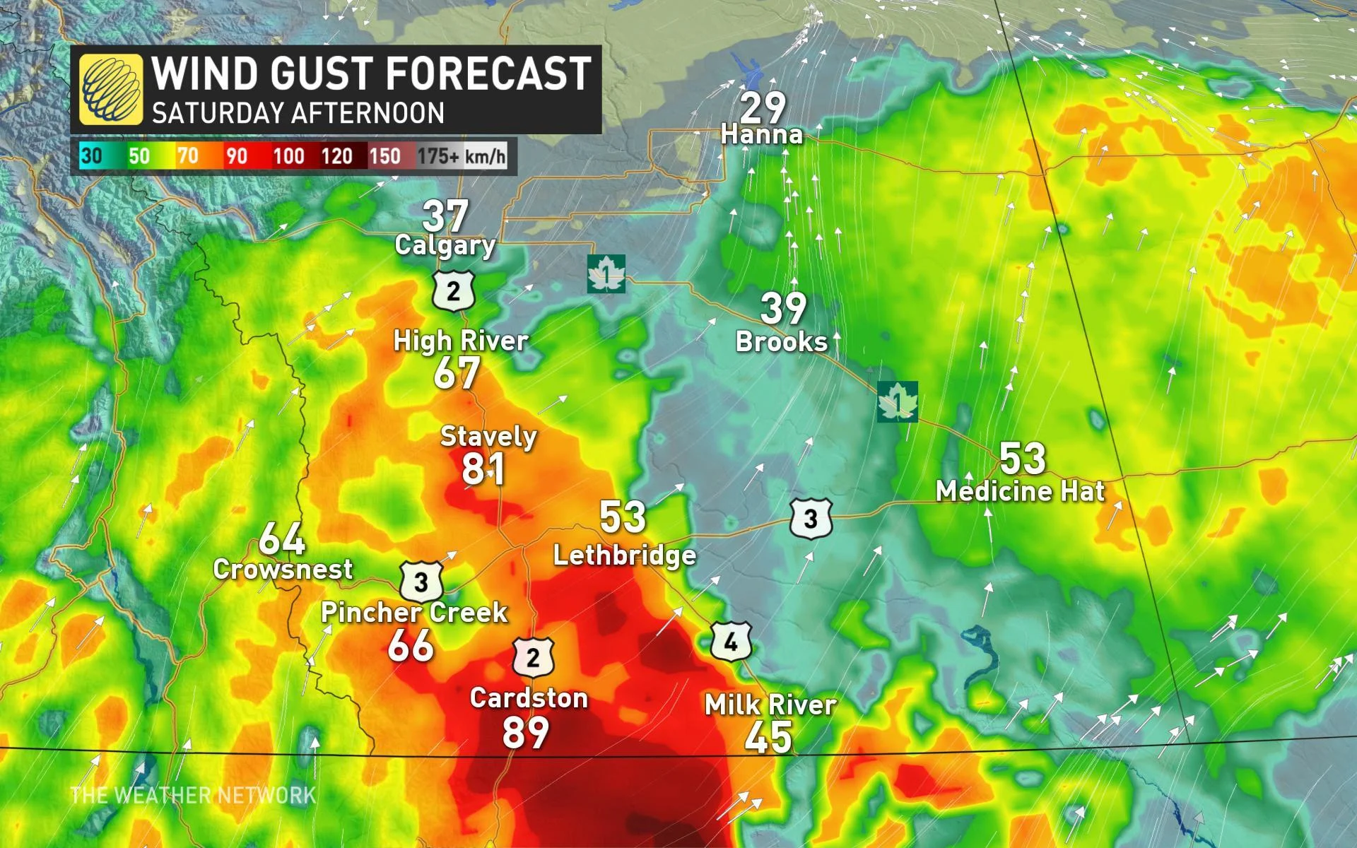
Gusts will pick up in the afternoon and continue into the evening before gradually easing off through the overnight and pre-dawn hours on Sunday.
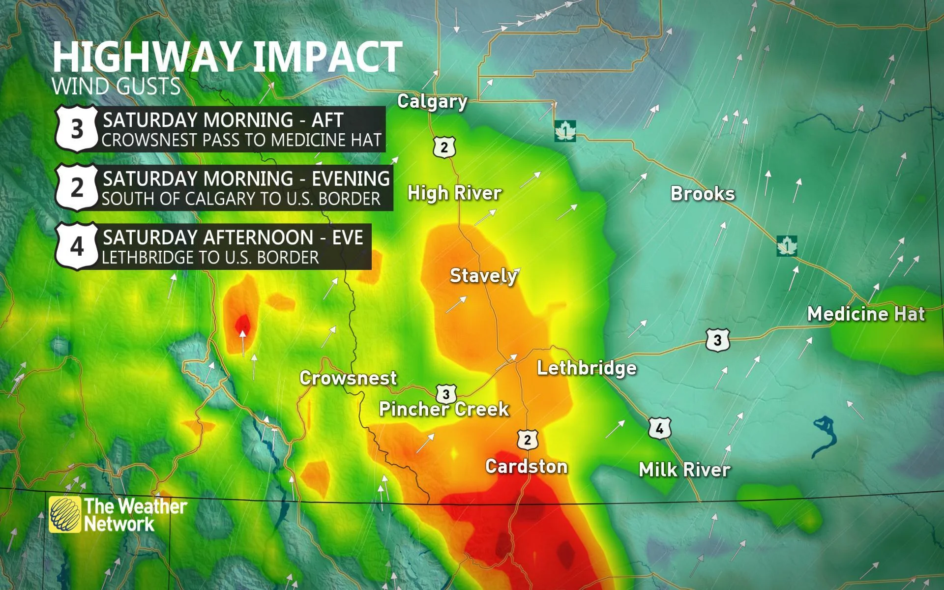
Lethbridge could see winds topping 80 km/h, while some isolated portions of extreme southwestern Alberta could experience gusts exceeding 100 km/h. Travel will be impacted.