
Alberta: Snow tapers off, but relentless cold roars back

The relentless cold that gripped the Prairies this season briefly retreated in the face of Pacific moisture that flowed in from the West and brought significant snow. But as the snow eases overnight, the cold is set to return. Details below.
WEATHER HIGHLIGHTS:
Light flurries ease overnight Saturday into Sunday
Cold temperatures return in the wake of system
See the latest warnings HERE
COLD SET TO RETURN
By Sunday morning, the last flurries will have exited Alberta, though snow will persist in Saskatchewan. Though the Pacific moisture that fuelled Saturday's snow moderated temperatures somewhat, high pressure moving into the region in its wake will send them tumbling once again.
Arctic high pressure will once again intensify through the weekend across the north, and that brings a renewed blast of cold for those not sheltered by the weak warm front in southern Alberta and southwestern Saskatchewan.
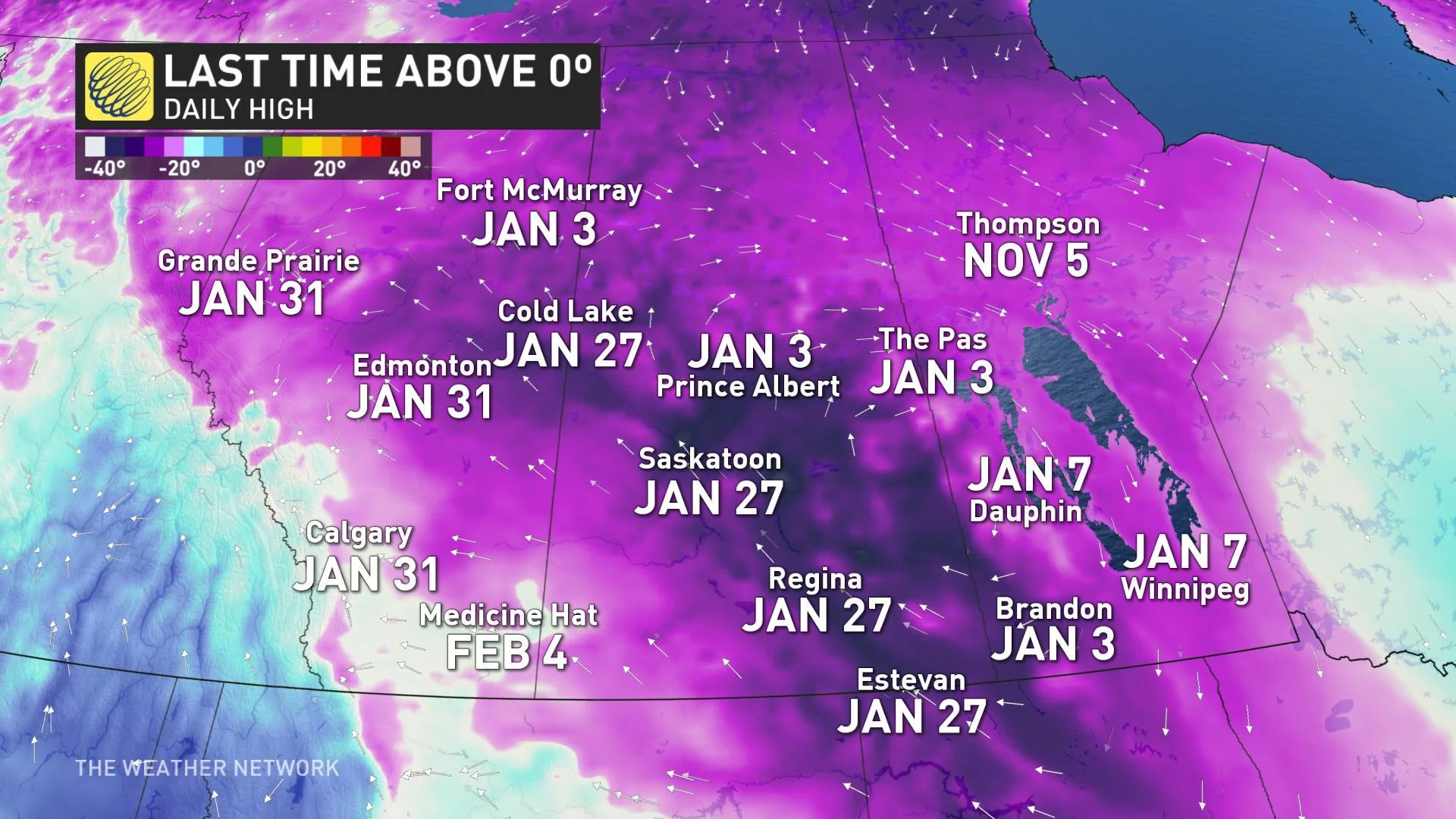
And those who haven't seen above-zero temperatures in weeks won't be breaking out of their cold streak any time soon, according to The Weather Network's Dr. Doug Gillham.
"Arctic high pressure will continue to dominate the Prairies," says Gillham, "with temperatures remaining well below seasonal for the rest of February and likely into early March."


