Alberta dives from heat to snow as wintry weekend system looms

Alberta faces an uncertain forecast as a wintry system threatens to bring the first snow of the season to parts of the province.
From heat to snow, it’s a classic weather story on the Prairies.
Calgary will dive from highs in the mid-20s to the first snowfall of the season in the same week.
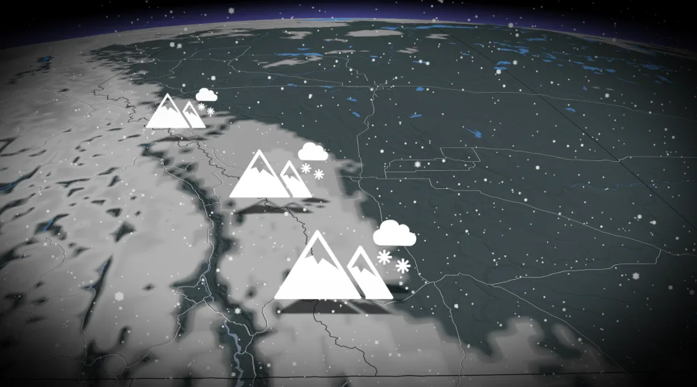
A system rolling across Western Canada will bring a decent thump of October snowfall to the Rockies and much of the Alberta foothills through this weekend.
MUST SEE: Marvel at the Pillars of Creation in new breathtaking view from Webb
Snow will begin to develop across the foothills on Friday night, spreading in intensity and coverage as we head into Saturday morning. Snowfall could reach as far east as the QE2 this weekend. Areas across the southeastern portion of the province will likely see rain for the majority of the system.
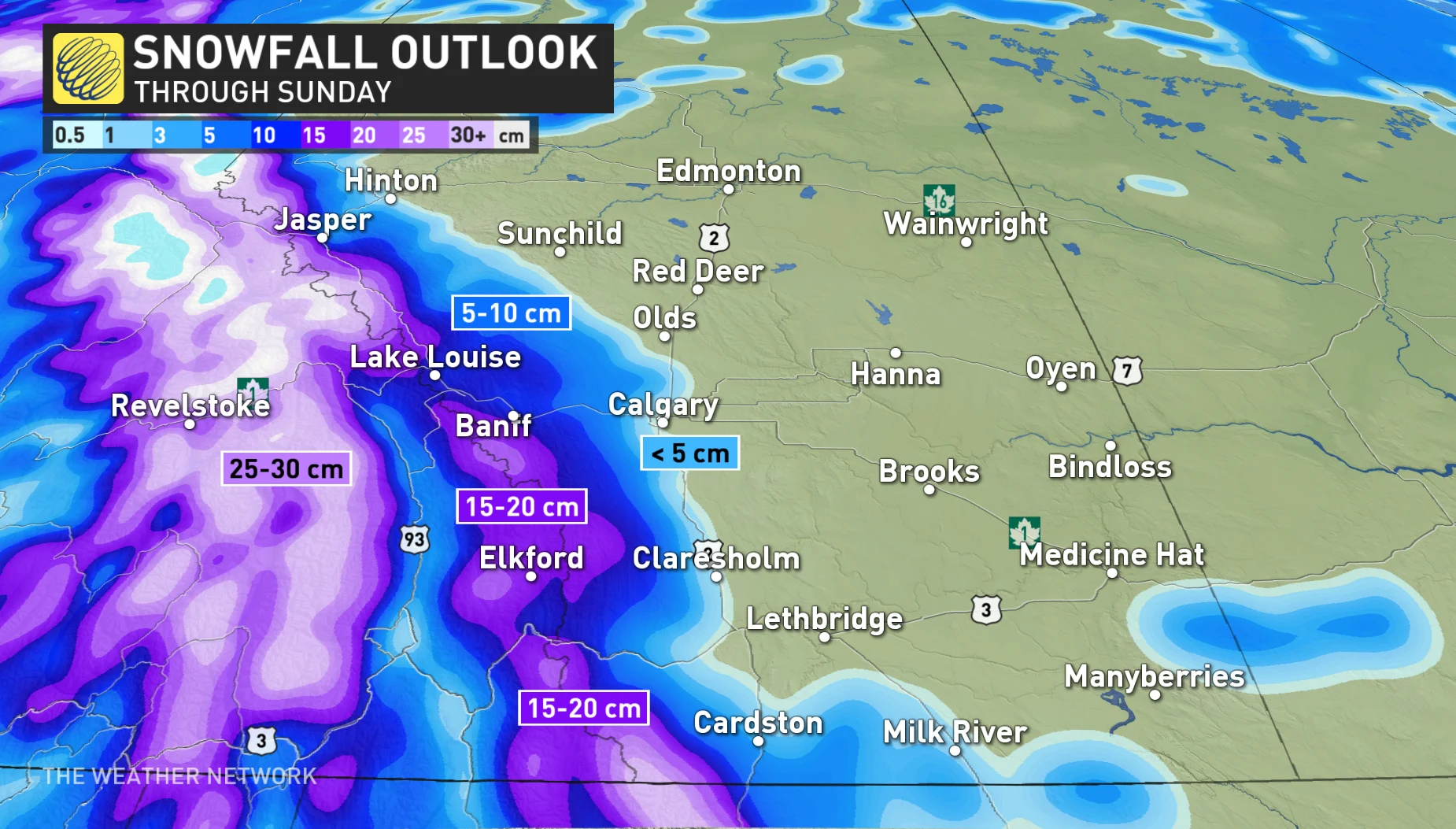
We’ll see the precipitation continue through the day on Saturday, gradually tapering off through the overnight hours into Sunday morning.
The system’s snowy effects aren’t quite set in stone.
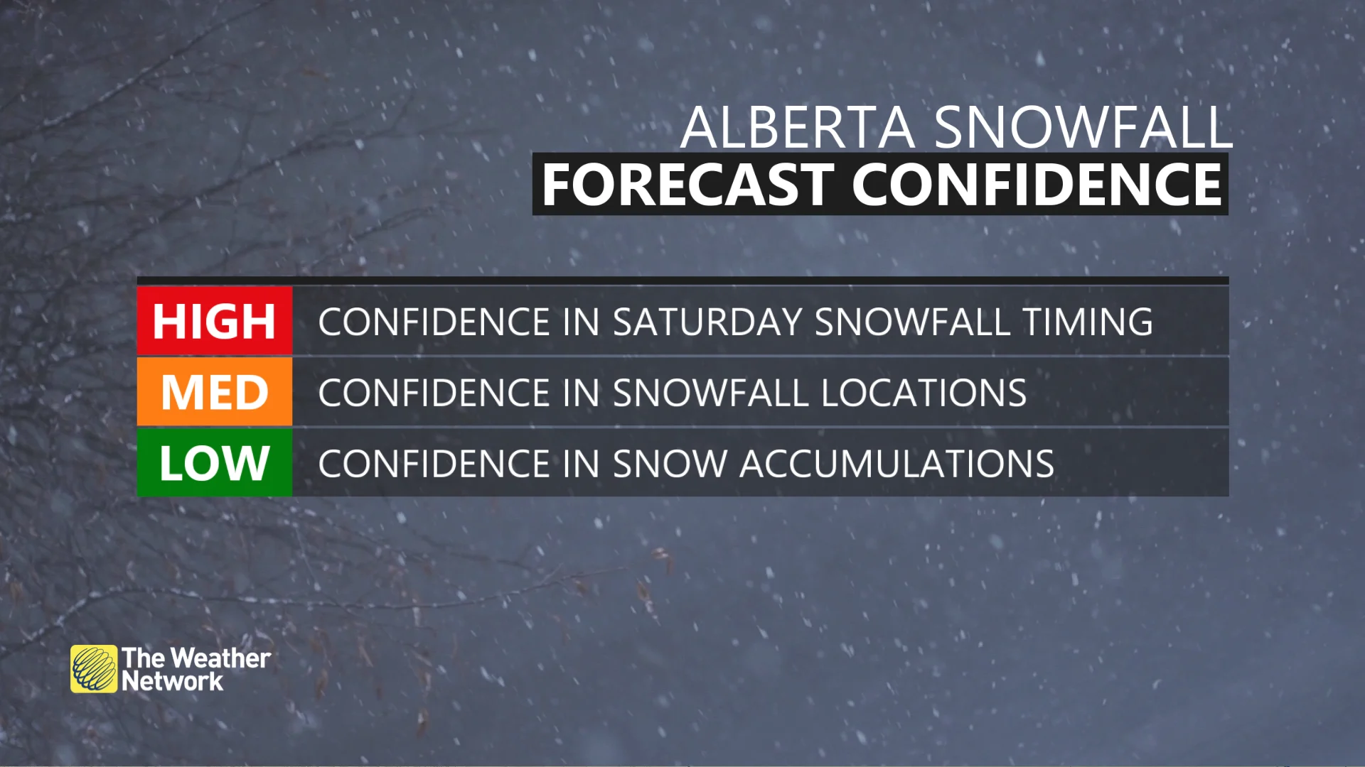
Forecasters are battling with some uncertainty surrounding Alberta’s impending snowfall. While there’s high confidence in the timing of the snow, it’s a little less certain exactly how much snow will fall and where the totals could add up.
READ MORE: Snow can spread and worsen the effects of pollutants in the environment
Check back frequently on Friday for the latest details on this fluid forecast.
Looking ahead, this system will herald a significant pattern change for Alberta. Wave goodbye to the summer-like warmth that’s bathed the region for so many weeks now.
Daytime high temperatures heading into next week will fall solidly on the cooler side of seasonal, with the mid-single-digits expected in Calgary through the end of the month.