One strong storm peaks in B.C., another already setting up behind it

Welcome to fall on the West Coast! No end in sight to the storm parade across British Columbia, with heavy rain to persist through the end of October.
B.C. is in midst of a one-two punch that will see two systems slam the province. The first, a powerful 'weather bomb', ramped up Thursday, bringing intense winds to parts of the coasts. While those, and the associated rainfall, will be waning on Friday, a brief break on Saturday will be followed by the second system – in all, as much as 200+ mm of rain could fall over the hardest hit areas from these systems through next week. More on this potent storm parade, below.
INTO FRIDAY: 'WEATHER BOMB' BEGINS WINDING DOWN
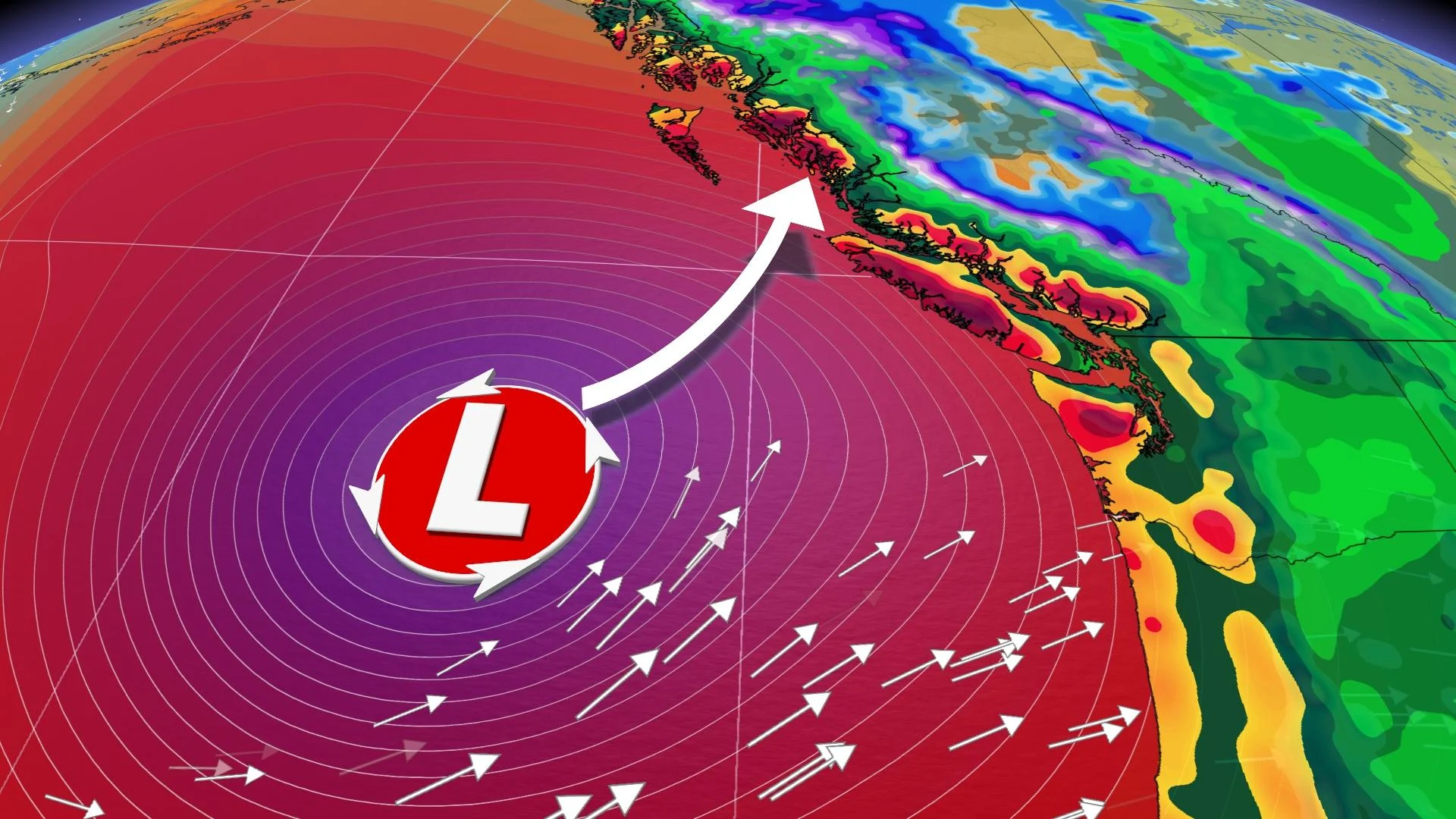
A potent 'weather bomb' ramped up its effects on the B.C. coasts Thursday, ahead of the front's arrival overnight into early Friday morning.
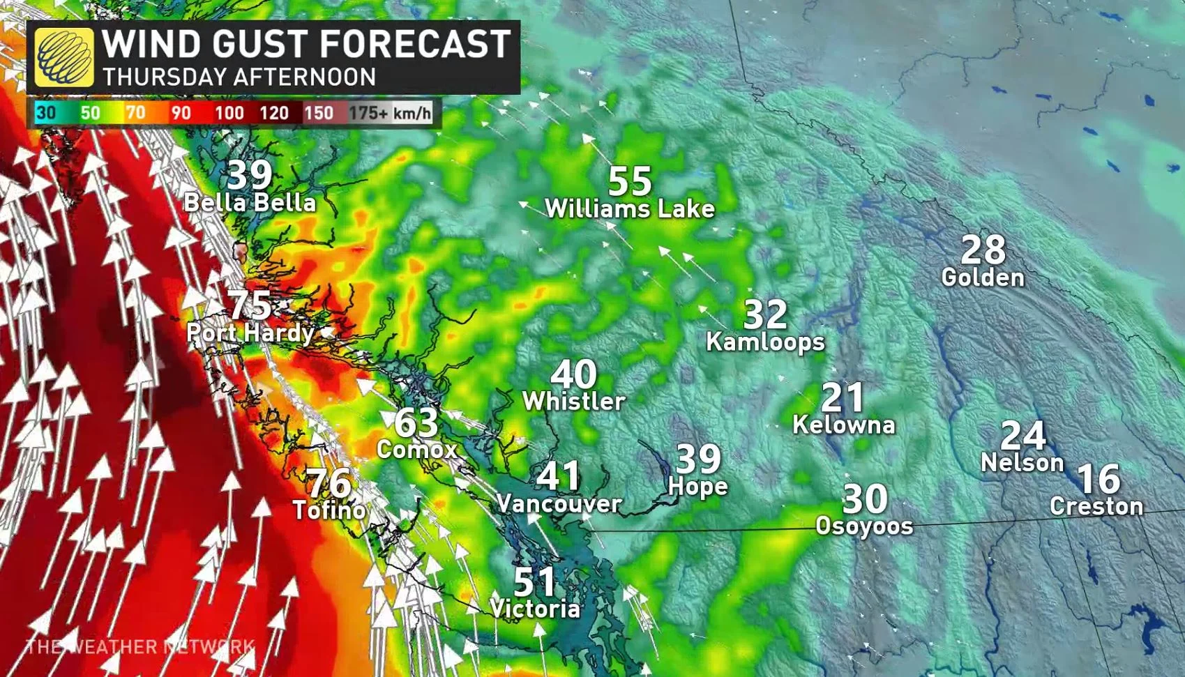
The system – which underwent a drop in pressure of more than 24 millibars in 24 hours – was expected to only skirt the province's coasts without making landfall. However, such an intensely low-pressure system typically means strong winds, and indeed, wind warnings were still in effect Thursday night for parts of the coasts, including eastern Vancouver Island and Haida Gwaii, where gusts could reach and exceed 120 km/h before winding down Friday.
Another factor is that this storm will be bolstered by the remnants from a typhoon in the western Pacific, somewhat boosting the amount of rain the system will bring.
The rain along the coast and Lower Mainland picked up through Thursday afternoon, and was expected to peak overnight, though remaining widespread during Friday as well.
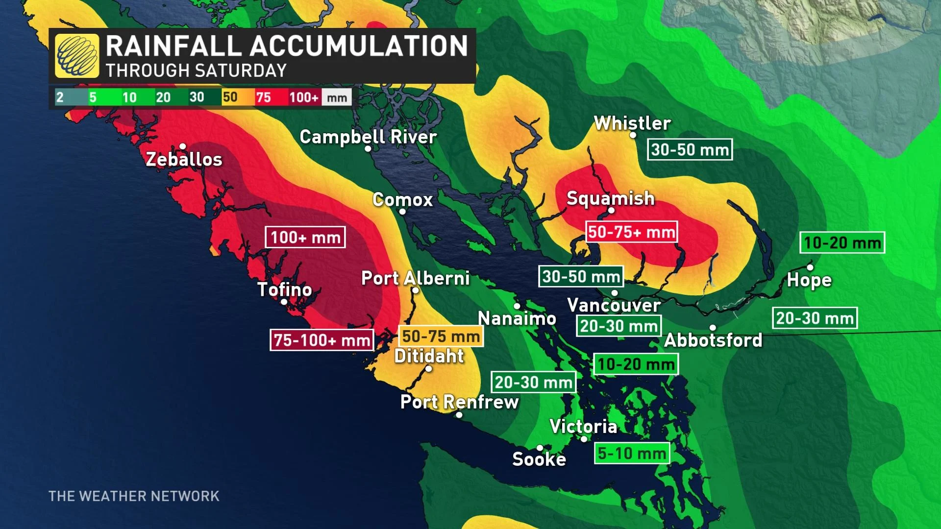
The heaviest amounts are expected for west Vancouver Island, with between 50-90 mm forecast through Saturday.
WEEKEND: BRIEF BREAK SATURDAY NIGHT BEFORE NEXT POTENT SYSTEM SUNDAY
The intensity of the first system is expected to wane to just showers Friday, but another heavy pulse of moisture is likely during the pre-dawn hours on Saturday. There will be just a brief break on Saturday evening, before the next strong storm pushes in as early as Sunday.
"While this storm on its own will pack a significant punch, luckily it will remain west of the South Coast, likely making a beeline for the North Coast, between north Vancouver Island and Haida Gwaii Sunday night," Weather Network meteorologist Nadine Hinds-Powell says. "This storm however, will intensify offshore, and weaken a bit before pushing onto the North Coast."
The associated fronts with this system however, are expected to re-intensify rainfall and high elevation snow for the South Coast and Lower Mainland beginning Sunday morning. Dangerous waves are also likely for the Pacific coastline once again.
The heaviest precipitation is expected Sunday evening for west Vancouver Island and the Lower Mainland, with rain continuing into Monday, followed by another front Tuesday and Wednesday.
"In essence, we'll see no let-up from the stormy conditions for the next several days," Powell says.
An additional 50-100 mm of rain is expected for west Vancouver Island through Monday, with between 30-60 mm expected north of the Fraser River.
Sunday's storm is also expected to bring strong wind gusts to coastal areas of west Vancouver Island and the Strait of Georgia, although not as strong as what Thursday's low will bring.
WATCH BELOW: THE THREE INGREDIENTS THAT CREATE B.C.'S UNPRECEDENTED SUNDAY LOW
Be sure to check back for the latest updates on the weather in B.C.