
A dreary, windy Mother's Day in Atlantic Canada as rain tapers off

Mother's Day won't be a washout for Atlantic Canada by any means, but it won't be pleasant, either. Rainfall continues Sunday but will gradually ease off through the morning and afternoon, with Newfoundland expected to see the heaviest amounts. Winds will still be strong in the day, but the most intense gusts of up to 100 km/h will diminish in Newfoundland in the morning. Temperature-wise, Halifax, N.S. could be the warmest city in the region Sunday. Beyond, more unsettled weather looms. For a more detailed look, see below.
SUNDAY: RAIN EASING OFF FOR MOTHER'S DAY, STRONG WINDS TO DIMINISH
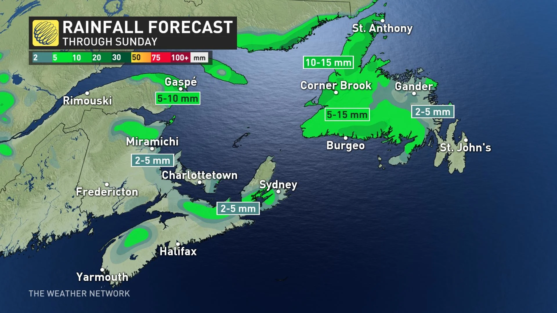
Effects from the latest system will be winding down Sunday, with most of the rain impacts pushing through Newfoundland. The eastern Maritimes will just see some light drizzle before it moves out.
Rainfall amounts left for the Maritimes will be light and scattered, while Newfoundland will take the brunt of the remaining precipitation. It will see lingering showers heading into the afternoon hours and could see an additional 5-15 mm Sunday.
A warm southerly flow will give Halifax, N.S. the chance to be one of the warmest cities in Atlantic Canada for Mother's Day, potentially reaching 13°C by Sunday afternoon. St. John's may hit 11°C.
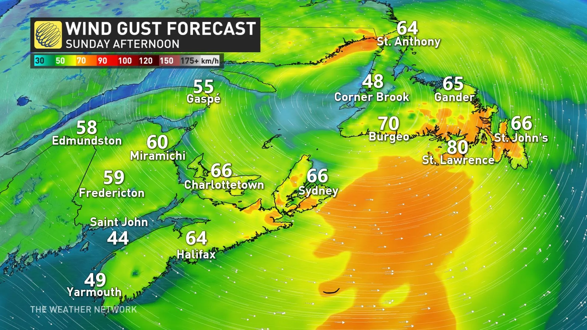
Blustery winds will linger in the region through the afternoon, with 50-60+ km/h gusts in the Maritimes, possibly hitting 70-80 km/h in Newfoundland. They will subside in the evening and overnight period.
Winds will be even stronger for northern and southwestern Newfoundland, where wind and Wreckhouse warnings are still in effect. The gusts will gradually ease Sunday morning but may still reach 100+ km/h in the aforementioned regions before diminishing below warning criteria as the winds shift to a southwesterly direction.
Meanwhile, temperatures will tumble into the low single digits for eastern Maritimes and western Newfoundland. But daytime highs could reach the low teens in areas where there is more sunshine and less cloud. Several cities, including Halifax, will remain below seasonal until late week, until a ridge of high pressure migrates over the area.
LOOK AHEAD: CHILLY AND UNSETTLED PATTERN CARRIES INTO NEXT WEEK
Another system will track south of the region on Monday, with rain expected to spread across the south shore of Nova Scotia. Temperatures will remain on the cool side.
Forecasters are watching yet another system after that, set to track into the Maritimes on Tuesday, lingering into Wednesday across most of Atlantic Canada.


