
Snow to give way to rain mid-week in southern Ontario

Temperatures to (briefly) warm up Wednesday
For the second time this week, parts of southern Ontario woke up to snow as an Alberta clipper raced through the region on Tuesday. This is actually part of a storm parade that will continue over the next 10 days. While most of the systems will be relatively weak Alberta clippers, it doesn't take much to slow travel times, especially with the changing conditions with these first season snowfalls.
Flurries and localized snow squalls will linger into early Wednesday, before a significant temperature bump that sees daytime highs rise well above the freezing mark on Thursday. Another significant system looks likely for the weekend, with the threat for more messy snowy weather. More on the timing and impacts of this week's systems, below.
Visit our Complete Guide to Winter 2022 for an in-depth look at the Winter Forecast, tips to plan for it, and much more!
SNOW TAPERS, RAIN MOVES IN
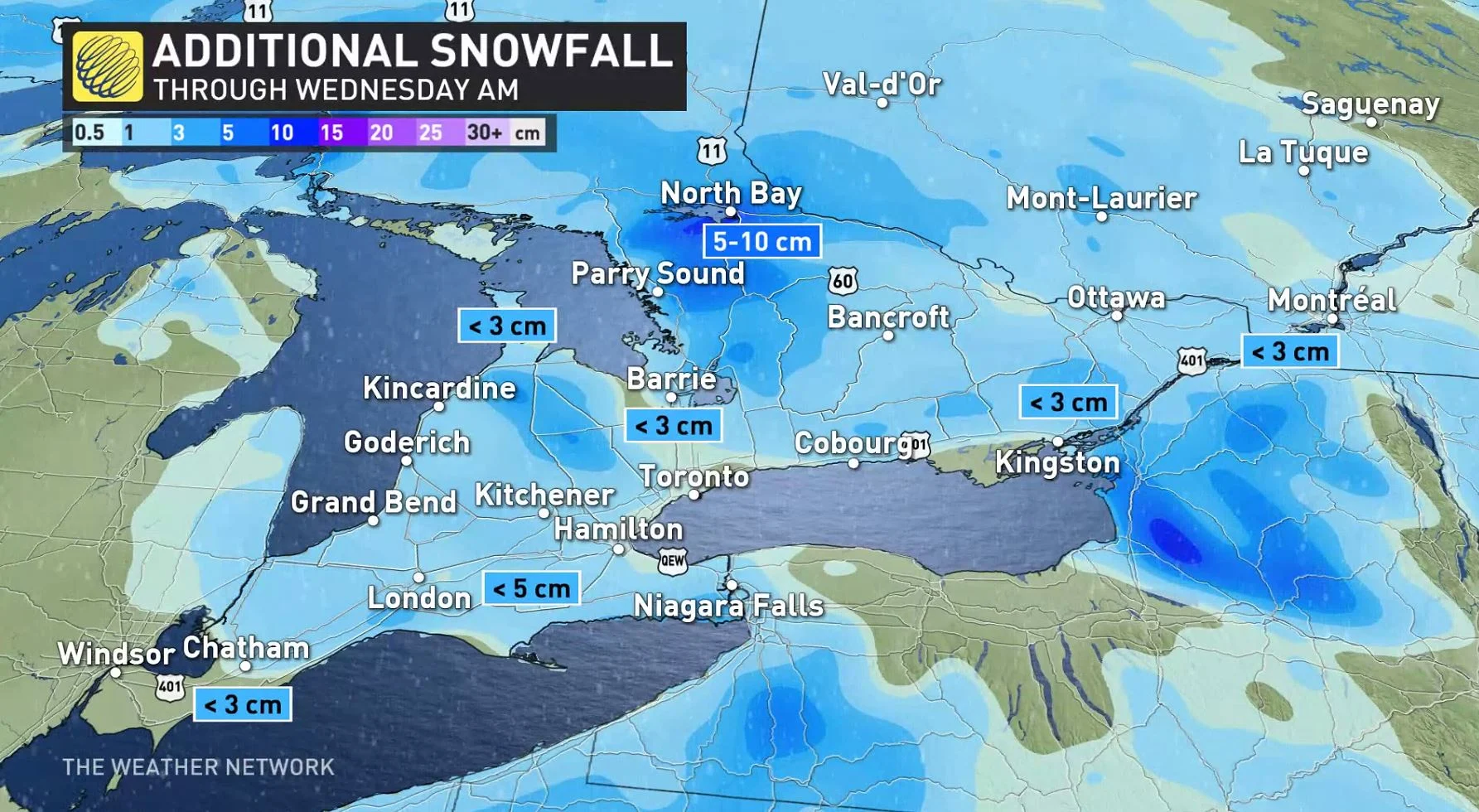
Motorists are advised to exercise caution as a cold front spread more snow and mixing back into southern Ontario Tuesday evening, with lingering flurries or some local snow squalls expected through early Wednesday, as well.
While accumulations are expected to be less than those seen earlier Tuesday, it's always worth reminding drivers to prepare for quickly changing and deteriorating travel conditions this time of year.
The region will get a brief reprieve from wet weather Wednesday afternoon, before wet snow or rain develops Wednesday night.
Precipitation will change to straight rain through Thursday as temperatures rise well above seasonal values.
Daytime highs will tumble back near freezing once again on Friday, becoming blustery with scattered flurries possible.
CLOSELY MONITORING WEEKEND SYSTEM
Forecasters are watching the next significant system for Saturday and Sunday, though with a wide range in computer model scenarios at this time. One shows a stronger system that tracks farther north, bringing snow first with a change to rain for more southern areas. Another scenario has a weaker system tracking south of the region, with just some light snow and minimal impacts expected.
"Regardless, this system should intensify and become a significant storm as it tracks into Atlantic Canada for early next week," Gillham says.
WATCH BELOW: WHAT'S SO SPECIAL ABOUT WINTER TIRES? THIS EXPERT HAS THE ANSWER
Thumbnail courtesy of @Maryannmommers1/Twitter, taken in London, Ont.
Be sure to check back for the latest updates on the unsettled week across southern Ontario.