Travel headaches possible as snow comes for B.C.’s mountain passes

A significant pattern change is on the way for British Columbia starting this weekend, with stormy weather lasting through next week for many folks.
The season’s first snowfall is on the way for British Columbia’s mountain passes through this weekend as a parade of storms begins marching into Western Canada.
DON’T MISS: From drought to deluge, B.C. pattern change brings unique hazards
The storms will wash over B.C. one after the other beginning this weekend and stretching into next week. Each one will bring the potential for heavy rainfall and even high-elevation snow across the province.
The main event arrives late this weekend and continues through next week. Several low-pressure systems will move into the B.C. coast from Alaska, bringing a widespread potential for rain and snow to much of the province.
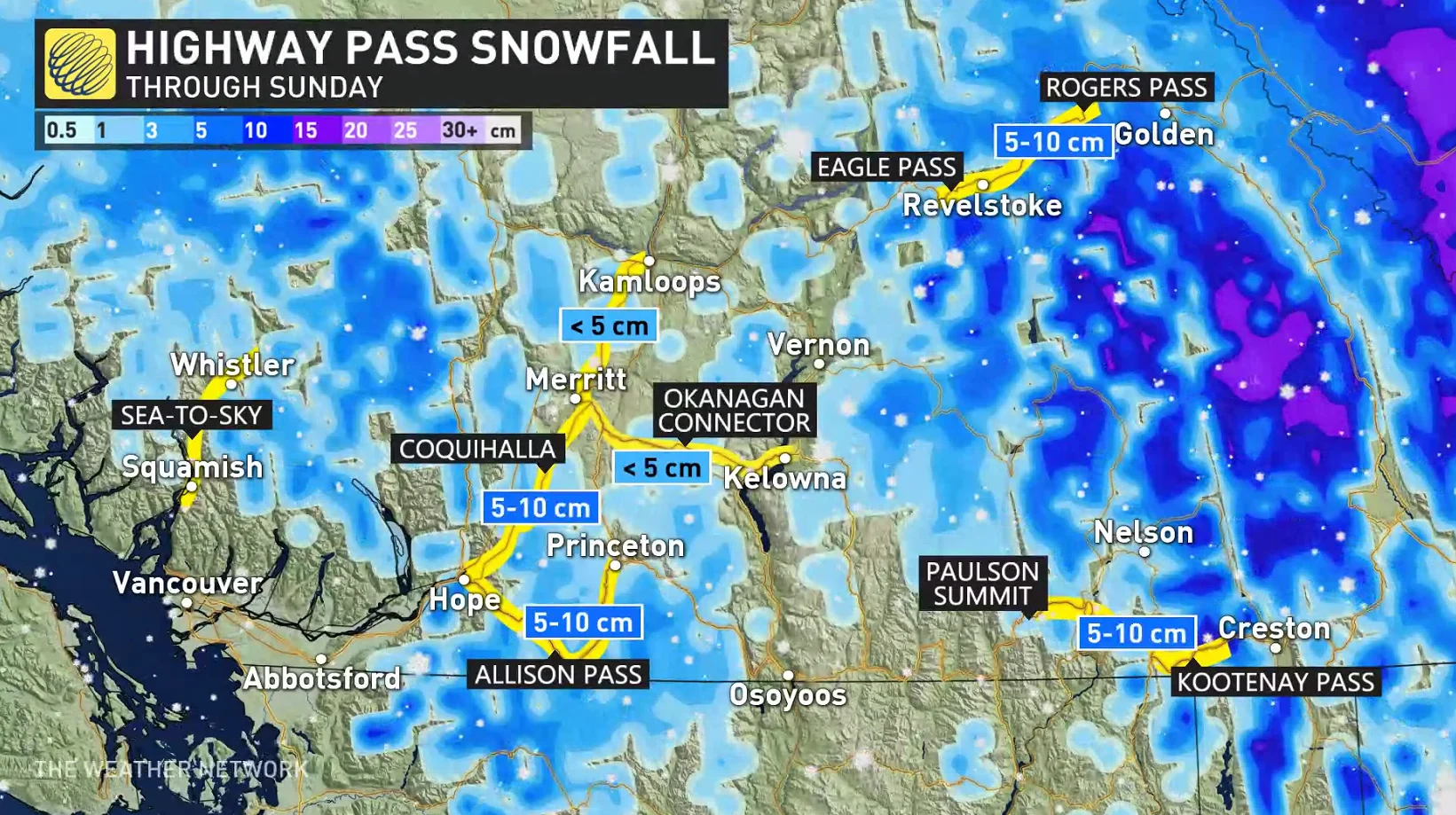
We could see 5 to 10 cm of snow across most of B.C.’s mountain passes through Sunday, which could hamper travel throughout the region.
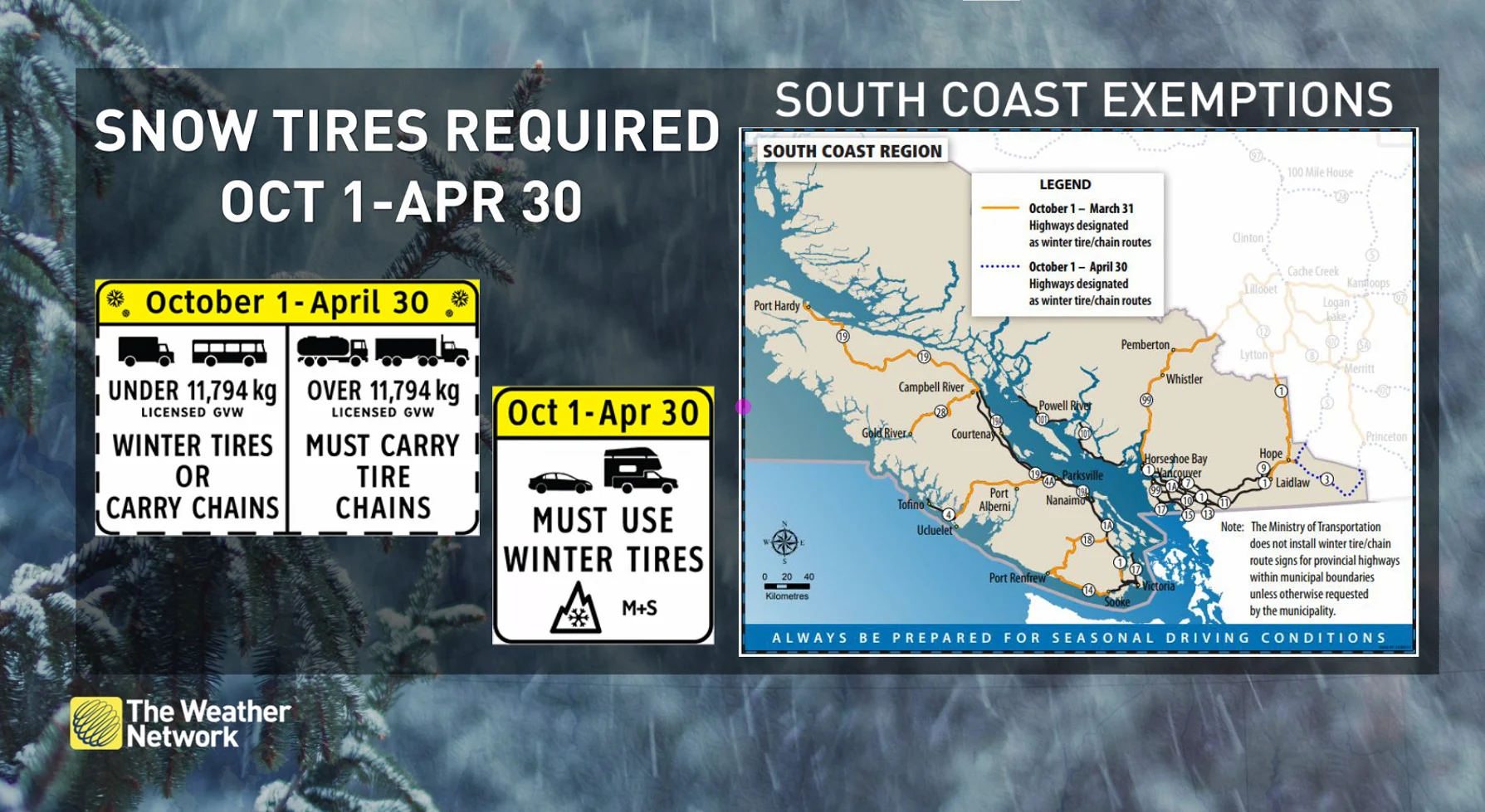
Don’t forget that winter tires are required by law across most of B.C. between October 1st and April 30th.
CHECK IT OUT: Fight off darker days with these 7 coffee makers
Folks across the South Coast and Vancouver Island recently jumped into Level 5 drought conditions, the worst category on the B.C. Government’s scale measuring the intensity of prolonged dryness across the province.
While any amount of rain will certainly help the drought situation, too much of a good thing can have detrimental effects. Water doesn’t absorb into parched soil very well, so the impending round of storms—and their associated heavy rainfall—could lead to localized flooding concerns.
Check back frequently as we head into the weekend as our team continues to monitor the track of the storms as they approach British Columbia, and where the bulk of the heavy rain and snow will fall.