A long weekend forecast for everyone, Canada

There'll be some blemishes here and there, but everyone will be able to salvage some much-needed and usable time outside. We all need it, right?
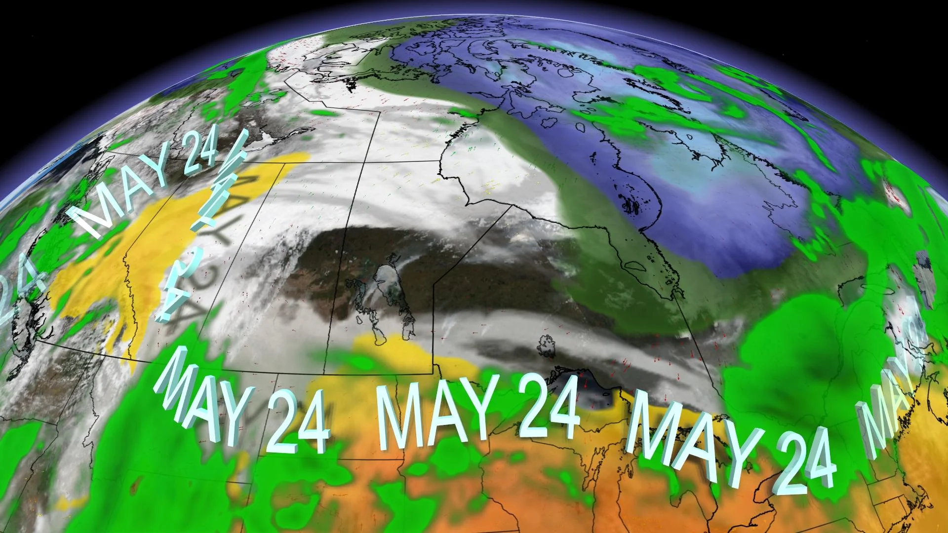
We made it to the unofficial start to summer. It's been an undoubtedly trying and tumultuous 15 months. Let's raise a glass to a long weekend forecast for everyone.
No one will coast through the long weekend without speckles of a little adverse weather. There'll be some blemishes here and there, but everyone will be able to salvage some much-needed and usable time outside. We all need it, right?
Scroll down, find your province, and unpack all the weather information you'll need to make the most of one of the most coveted weekends of the entire year.
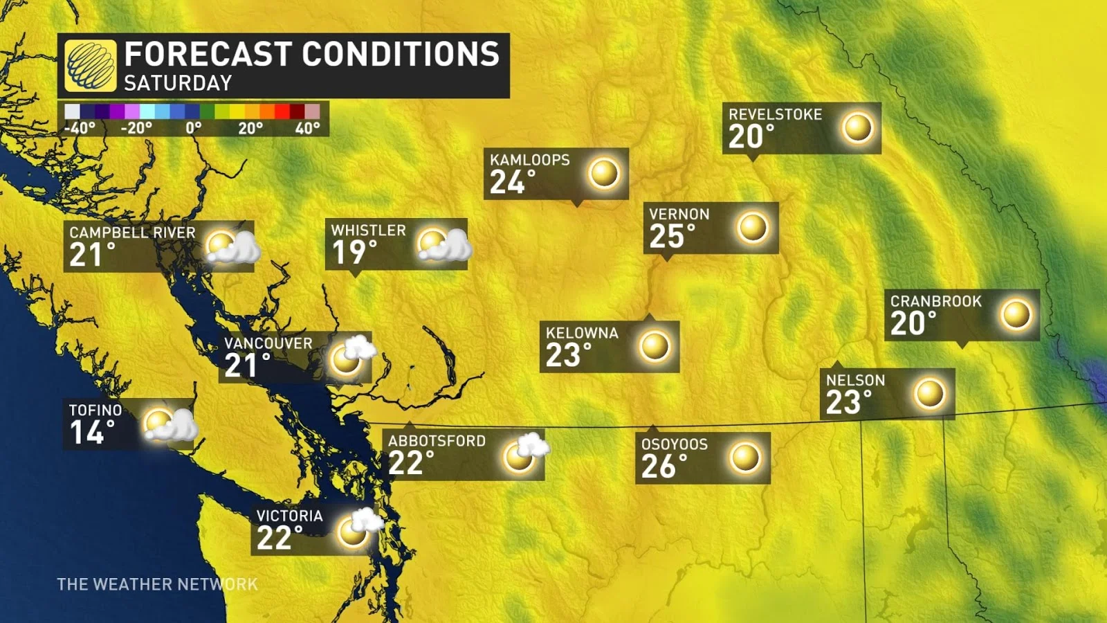
BRITISH COLUMBIA
We're kicking into the long weekend with some pre-summer style, compliments of a ridge of high pressure popping up over the province. Think upper teens right by the water -- and when you move inland, you're well into the 20s throughout the southern valleys.
On Sunday, we'll have to increase the threat of showers and thunderstorms for coastal and inland sections. An upper trough wants to bring some unsettled weather back into the picture on Monday, knocking temperatures back to seasonal.
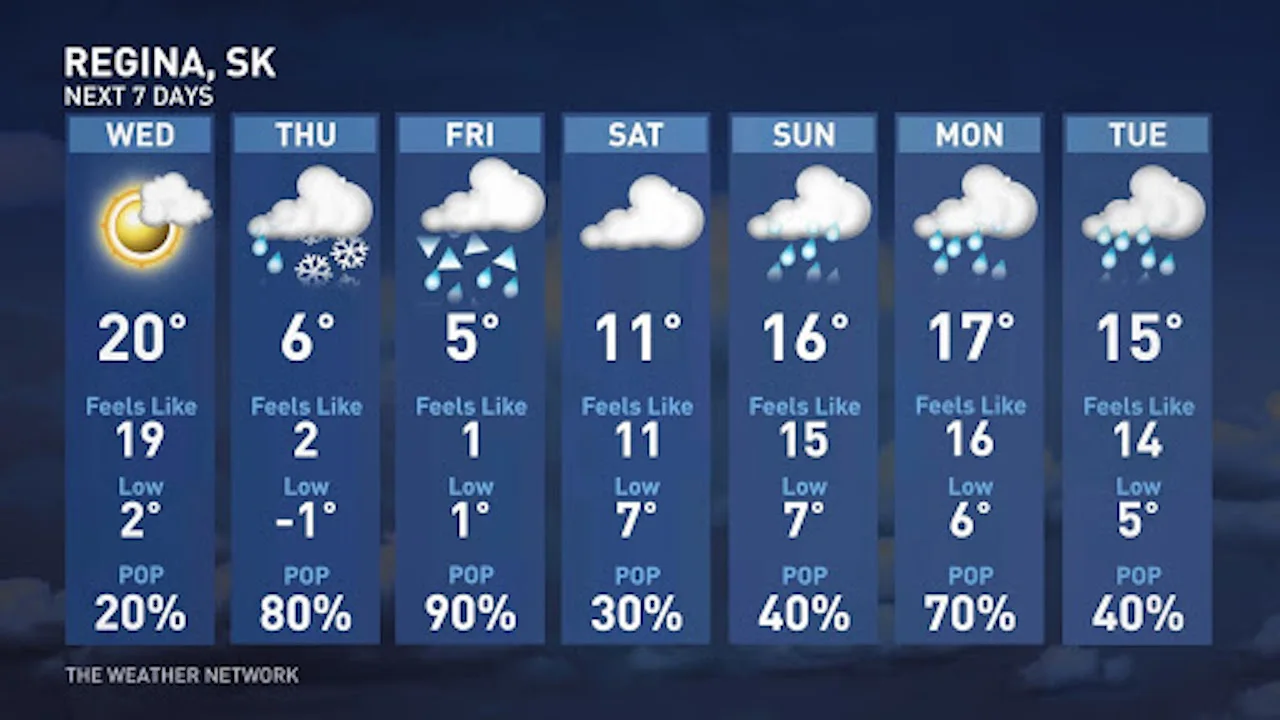
PRAIRIES
We'll call this a comeback story.
It'll be an improvement because no snow is in the forecast, the temperatures warm up, and it's a big and much-needed win for the agriculture and drought situation. It won't erase it, but we'll chip away at the rainfall deficits as of late.
Northwestern Alberta is forecast to hog what little warmth is available from the ridge to the west.
Saturday may feature some thundery rain-showers across southern Manitoba -- and by late Sunday, a more sizeable system gets its act together. As the low unravels across the Prairies, hours of much-needed steady rainfall are on tap.
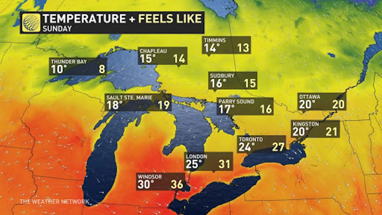
ONTARIO AND QUEBEC
Start warm and humid, but finish towards the seasonal mark. The sudden summer weather will relinquish. The ridge peaks on Friday as a more northwesterly flow develops over southern Ontario and Quebec.
Upper trough. Waves of showers and thunderstorms will surf the backside of the ridge. Northwestern Ontario looks particularly unsettled on Saturday, with the threat of heavy downpours and thunderstorms throughout the day.
Quebec starts the weekend on the showery note. Showers are likely for parts of Saturday, then another wave of moisture is on tap for Sunday, as well.
Don't worry -- there will be rain-free periods, too. By the time the long weekend is over, pockets of 30 mm of rainfall are likely to fall by Monday.
ATLANTIC CANADA
Finally, a taste of early summer! But soak this one in early because the finish looks a tad ugly. We'll start by tracking a boundary sagging into the region on Saturday. Most of Nova Scotia remains warm and dry -- with temperatures in the low 20s away from the ocean.
Sunday is a trough day, but we'll try to squeeze out a little bit more warmth across the southwestern Maritimes. The transient ridge moves on out; consequently, a punchy, cool trough straight from the Labrador Sea fills the gap. The core of the chilliest air wants to swing over Newfoundland during the holiday Monday, and there's an increasing threat of some wet snow for inland sections.
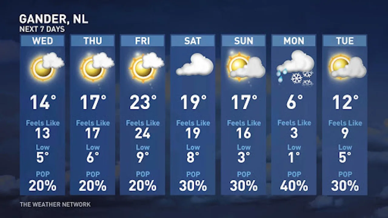
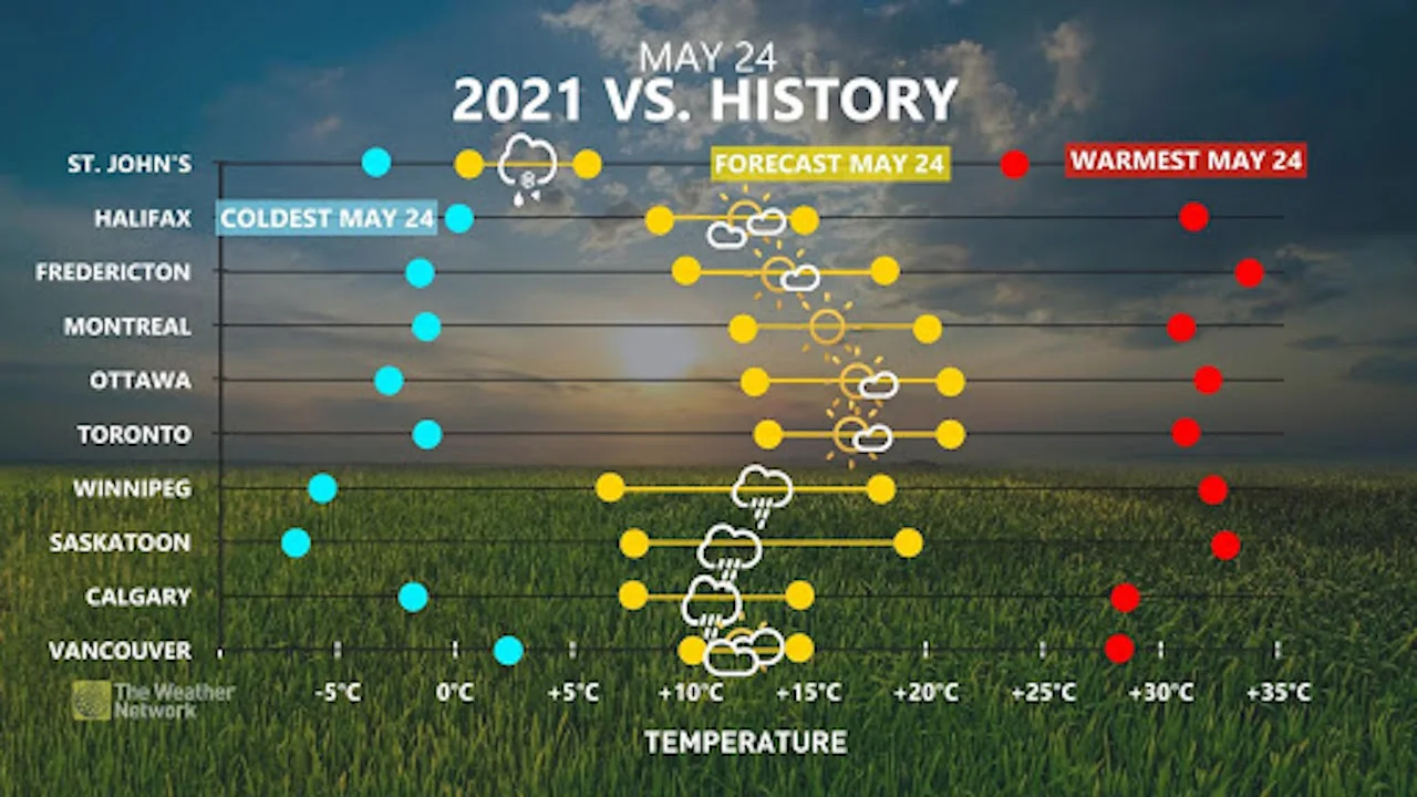
Sorry, Newfoundland, you have some the chilliest weather for the holiday Monday. You can see you’re a bit of an outlier compared to the rest of the country:
NORTHERN CANADA
The warmest territory by far this long weekend is the Northwest Territories, benefiting from that B.C.-Alberta ridge. Some locales away from the chilly, frozen lakes feature a treat into the low 20s. A pocket of cold air will sit off Baffin Island through the weekend, giving bursts of snowfall for Iqaluit and bringing temperatures near 5°C below seasonal by Saturday.
Cheers! Have a safe and happy long weekend, everyone.