Prolonged snowfall likely to create havoc on the roads on the Prairies

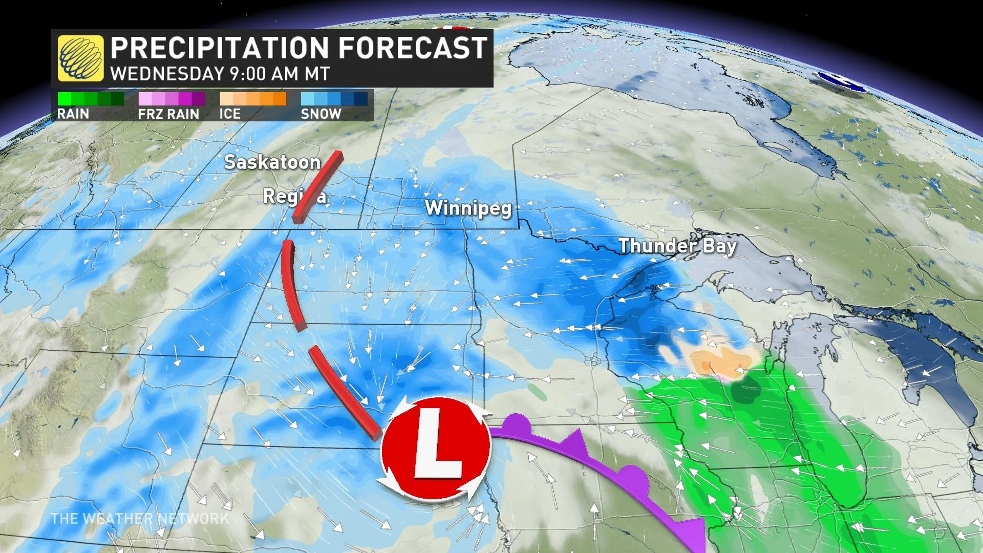
This week, a Colorado low will march across North America with far-reaching impacts including an extended period of heavy snowfall stretching more than 1,000 km from Saskatchewan to northwestern Ontario.
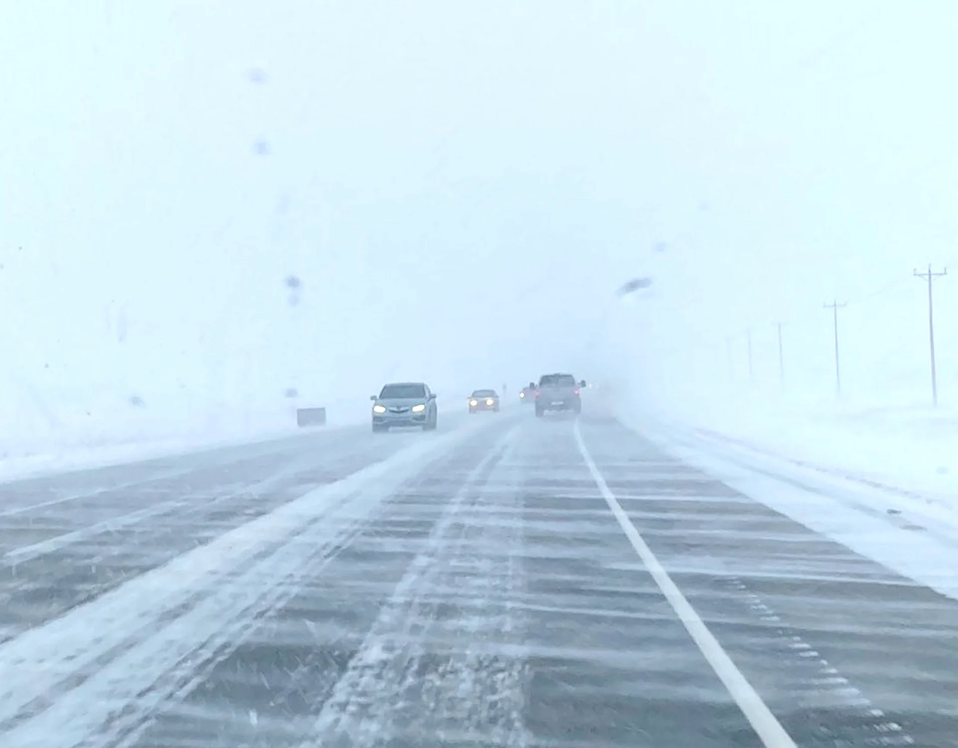
Those in the southern section of the eastern Prairies will soon be bracing for a significant winter storm. Portions of three provinces are in the crosshairs of a major system tracking across North America, expected to bring 10-20+ cm of snow into Friday for some.
The snowfall is expected to persist over an extended period of time, so travel is likely to see serious impacts including the possibility of road closures.
DON’T MISS: A looming December chill could boost Canada’s odds of a white Christmas
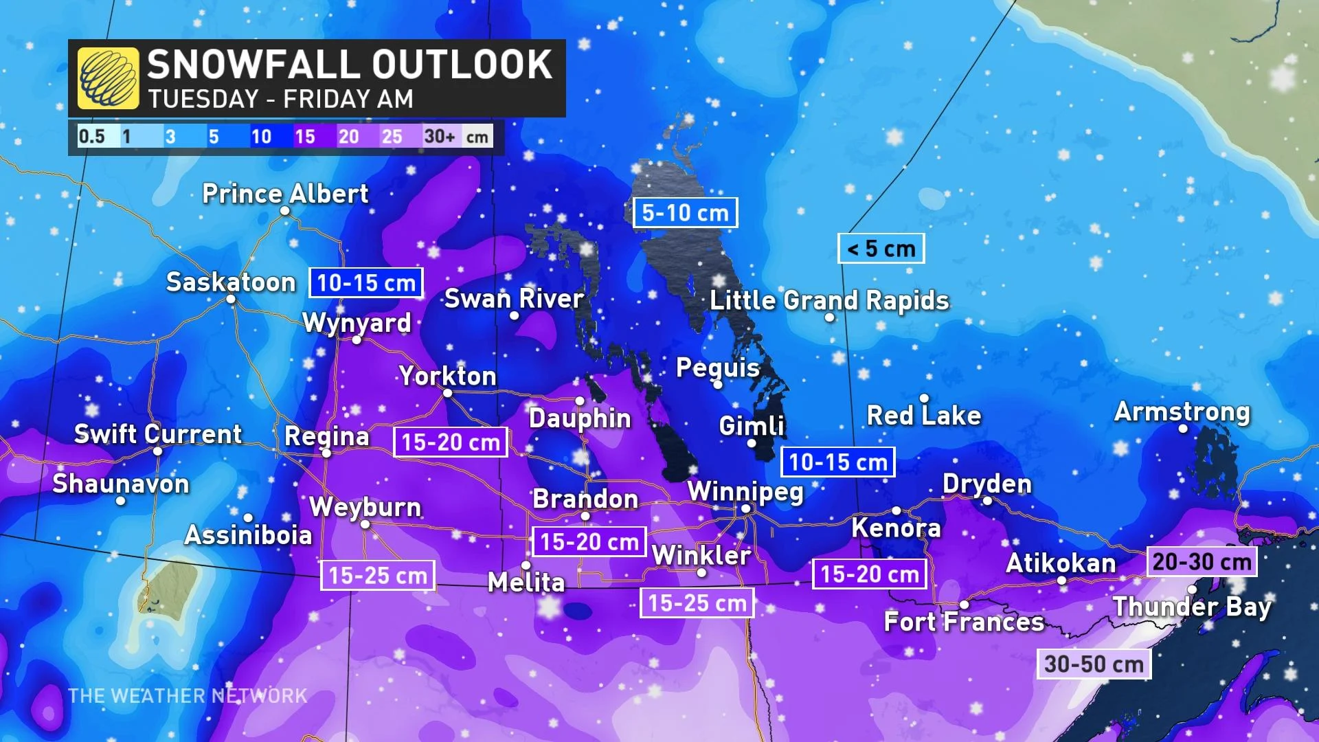
Saskatchewan, Manitoba and northwestern Ontario will have bouts with heavy snowfall and potential blizzard conditions for the second half of the week. Special weather statements are in place.
The Colorado low will move through the U.S. Upper Midwest, bringing snow into southeastern Saskatchewan and southern Maitoba starting Tuesday night and into Wednesday morning.
With the above seasonable temperatures in place as the low-pressure system approaches, the snow is expected to be a heavier, wet snow. The worst conditions are expected to be in the communities along the international border.
The accumulations of snow will be wide ranging and quite significant in certain parts. Southeastern Saskatchewan, including Regina, will see between 15-25 cm.
Travellers using the Trans Canada-Highway should exercise caution as the roads will get hit by varying amounts of snowfall.
The system will begin to impact northwestern Ontario on Wednesday and continue into Friday. Thursday will be the worst for travelling as this is when snow will be the heaviest.
The heaviest snow will fall along the Canada-U.S. border with most areas south of the Trans-Canada Highway seeing 10-25 cm, with the chance of close to 30 cm for Thunder Bay, Ont., and surrounding areas.
Temperatures this week won’t be too far off from seasonal, but the big story is the blast of Arctic air moving in straight from Siberia into the western Prairies, and then spreading south and east, starting this weekend.
It will continue into next week with dangerously cold temperatures expected -- high temperatures in the mid-to-upper -20s. Frigid weather will continue through Christmas.
Thumbnail courtesy of Trevor/Twitter.
Stay tuned to The Weather Network for the latest forecast updates on the Prairies.