Prairies: Wind chills stay frigid with repeated shots of arctic air

Plunging temperatures will make the first half of this week feel more like November or December for much of the Prairies, thanks to an infusion of Arctic air. While the extreme pattern will somewhat relax at times, several reinforcing shots of cold will persist well into next week and beyond. More on how cold things will get, plus the timing of a weak clipper that could bring additional snow flurries late week, below.
WEATHER HIGHLIGHTS
Daytime highs below freezing through Tuesday as arctic air floods south
Brief break in the frigid pattern in Alberta mid-week, but with several reinforcing shots of arctic air into next week
Stay up-to-date on the ALERTS in your area
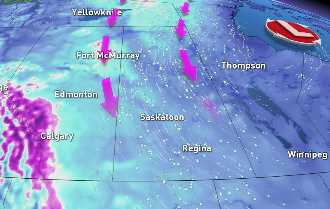
A low pressure system over Hudson Bay and a ridge of high pressure in B.C. will continue to drive arctic air down into the Prairies for at least the first half of this new week.
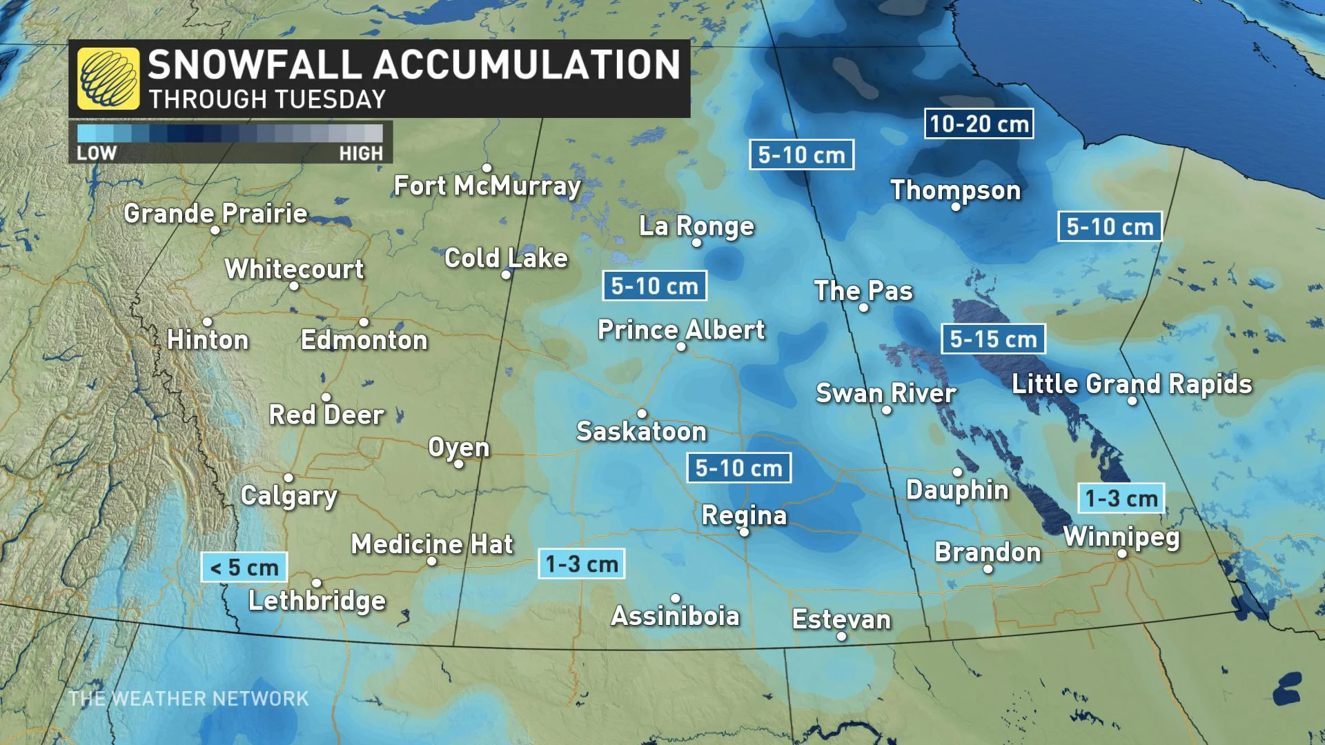
Bursts of snow have also spread across the region, and while much of Alberta will clear into Tuesday, Saskatchewan and Manitoba will see continue to see snow flurries with isolated pockets of 5-10 cm possible.
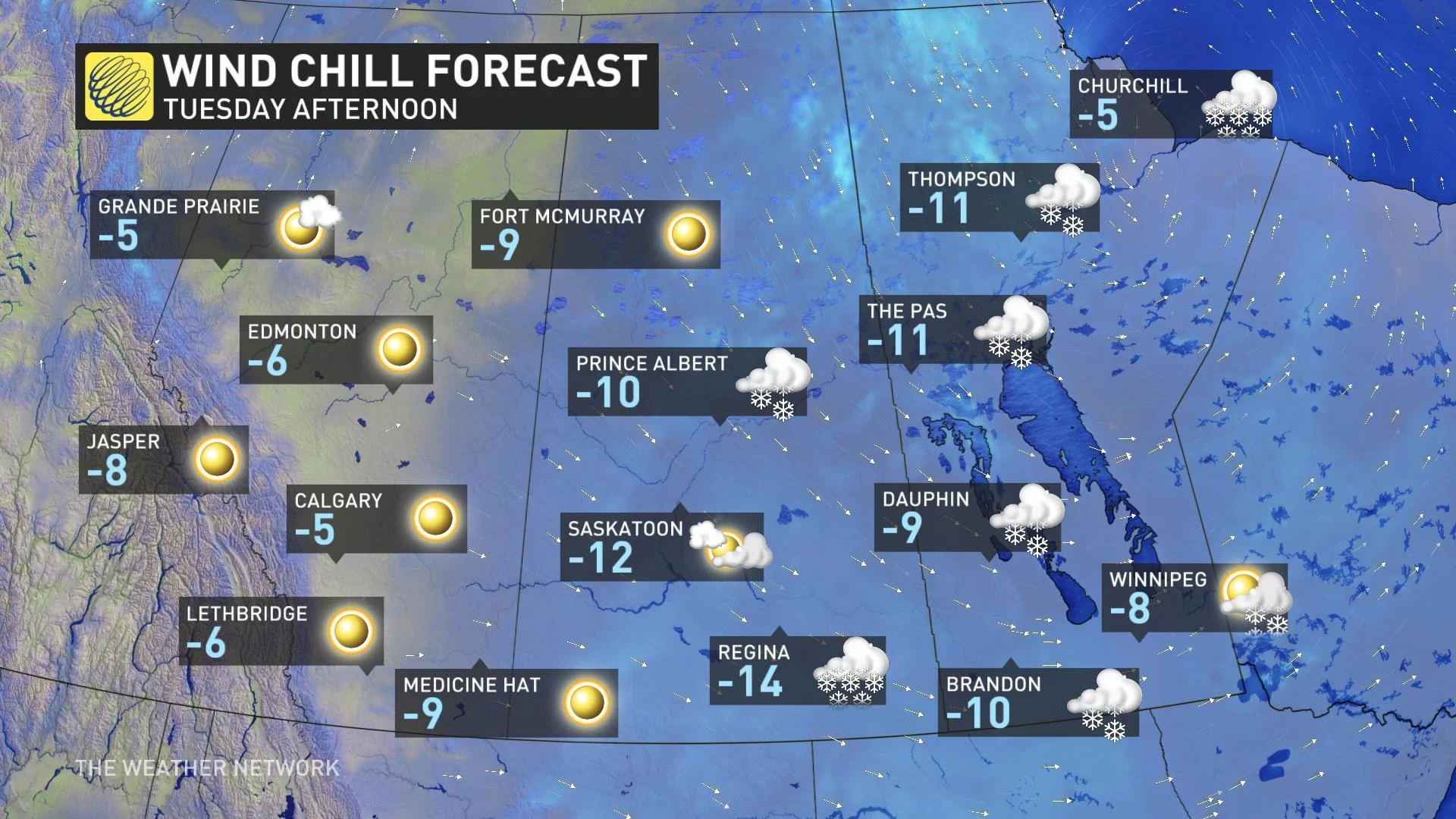
"Tuesday will also be another frigid day across the Prairies as wind chills remain in the minus double digits for many," says Weather Network meteorologist Kelly Sonnenburg.
SEE ALSO: Canada has some freak fall frost stats this year
STAYING FRIGID INTO NOVEMBER
The upper level trough will remain in place across the eastern Prairies this week, keeping the region locked into a rather frigid pattern. There will be some relief through mid-week, thanks to a slight pattern shift.
"That's as the Pacific ridge nudges just enough into Alberta to bring temperatures back up above the freezing mark on Wednesday," says Sonnenburg.
WATCH BELOW: TRACKING A BRIEF MID-WEEK MILDER BREAK
Later this week, however, a weak clipper will track across the northern Prairies bringing some scattered flurries and mixed precipitation through the day on Thursday and into Friday.
"We'll see several reinforcing shots of arctic air this week and next week and likely beyond, but there are no major storms in sight through the weekend, only brief bursts of snow with each passing cold front," adds meteorologist Dr. Doug Gillham.


