
Ida's remnants still sit over parts of Atlantic Canada, 120+ mm of rain reported

Remnant moisture from what was once Hurricane Ida continues to stall over parts of Atlantic Canada through Friday, bringing an unsettled start to the Labour Day long weekend.
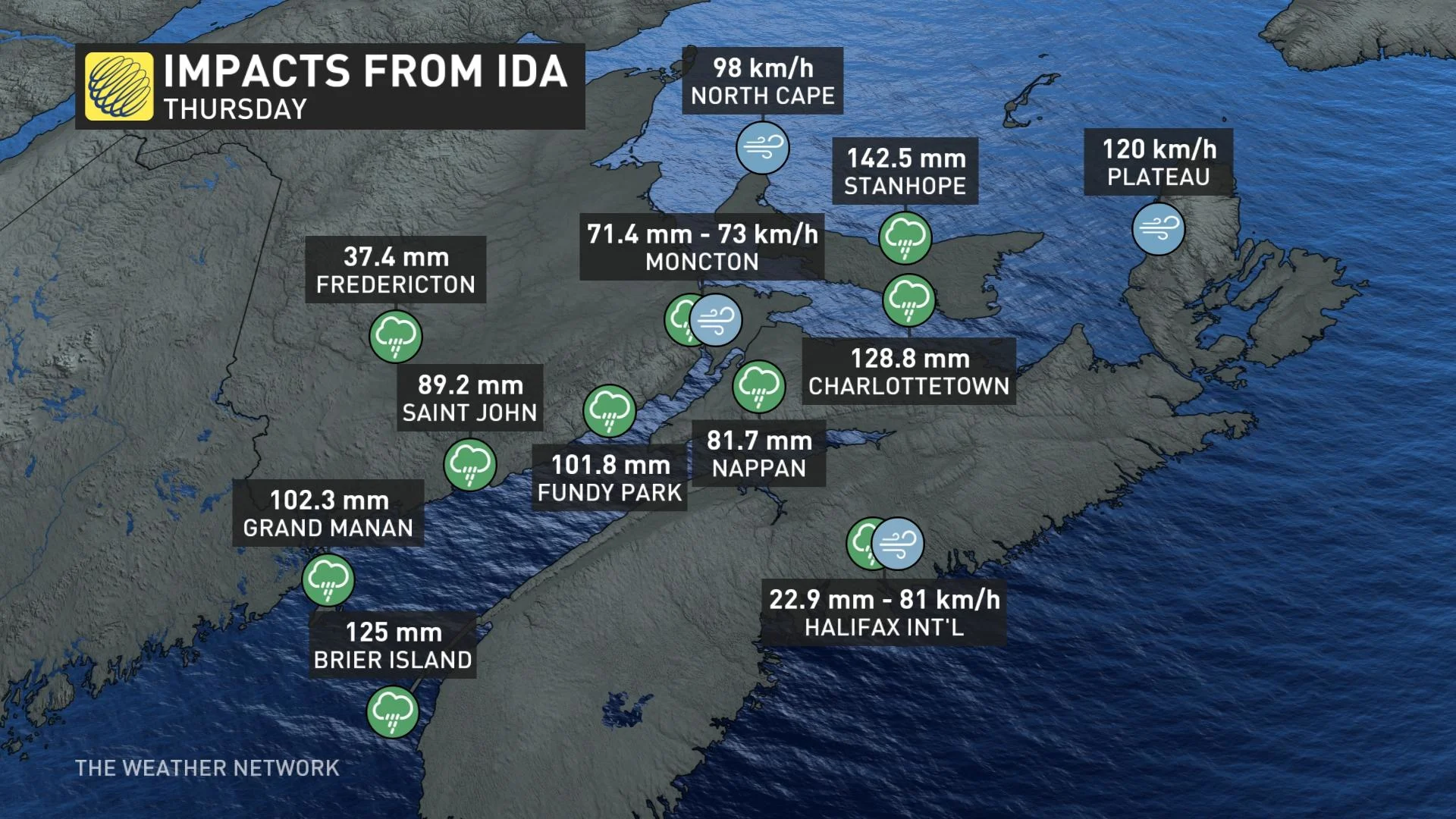
Hurricane Ida's remnants, boosted by an unrelated system, fell upon the Maritimes with great force Thursday, bringing very heavy rain and strong winds to many communities across the three provinces -- even triggering some localized flooding, difficult driving conditions and power outages in some spots. Ida's remnants will be slow to depart, bringing an unsettled start to the final long weekend of summer. More on the impacts so far and what's still to come as we near the peak of the Atlantic hurricane season, below.
FRIDAY INTO SATURDAY: IDA'S REMNANTS LINGER
Though not as powerful as its deadly impact on the U.S. Northeast, Ida's remnants still had a fair bit of punch to them as they rolled through the Maritimes Thursday.
With rainfall warnings widespread, the storm's totals ranged from manageable, to heavy enough to trigger localized flooding, particularly for southern New Brunswick, and parts of Nova Scotia and Prince Edward Island.
By the early hours on Friday morning, upwards of 120 mm of rain had fallen over the hardest hit regions. Charlottetown, PEI saw the most rainfall in a single day since 1942 and recorded over 100 mm for only the fourth time ever.
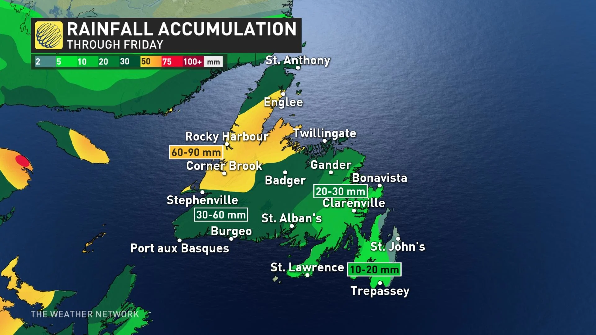
The storm crossed into the Gulf of St. Lawrence late day on Thursday, with the rain set to continue in Newfoundland for Friday. By the time all is said and done, between 60-90 mm of rain is likely in the west of the island, with closer to 10-20 mm for the Avalon.
"Heavy downpours can cause flash floods and water pooling on roads. Localized flooding in low-lying areas is possible," a rainfall warning from Environment and Climate Change Canada reads.
There's the potential for rainfall rates to exceed 10 mm per hour over some areas, with the heaviest rain occurring during the daytime hours.
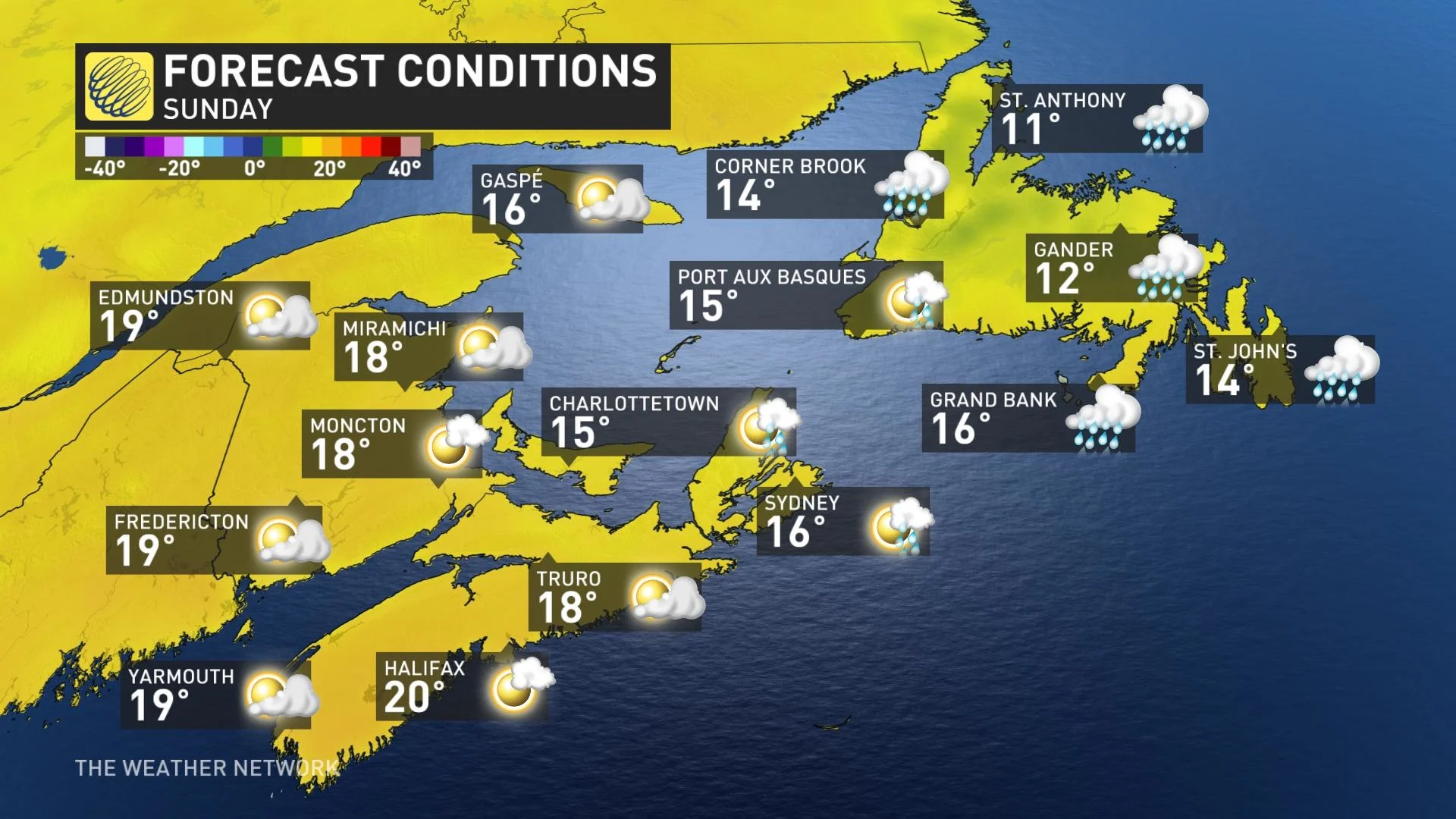
Ida's remnants will be slow to depart, as the system lingers over the region in the form of a stalled area of low pressure. Showers and cloud cover will hang on into the early part of the upcoming long weekend before high pressure slowly shoves the system away.
LONG WEEKEND: Last long weekend of summer a bit rocky for parts of Canada
In the wake of Ida, a shot of cooler air will bring a taste of fall-like temepratures, with highs only in the mid teens under cloudy and showery skies. Conditions will slowly improve from west to east later in the weekend.
WATCH BELOW: MILDLY CONCERNED ABOUT HURRICANE LARRY, CHECK BACK REGULARLY ATLANTIC CANADA
As one tropical system's impacts move away from Atlantic Canada, forecasters are already eyeing the next potential hit – while stressing that it's several days distant, and much is still unknown.
Hurricane Larry, which strengthened over the eastern Atlantic early Thursday, is forecast to become a major hurricane as it moves over the warm waters of the central Atlantic this weekend and next week.
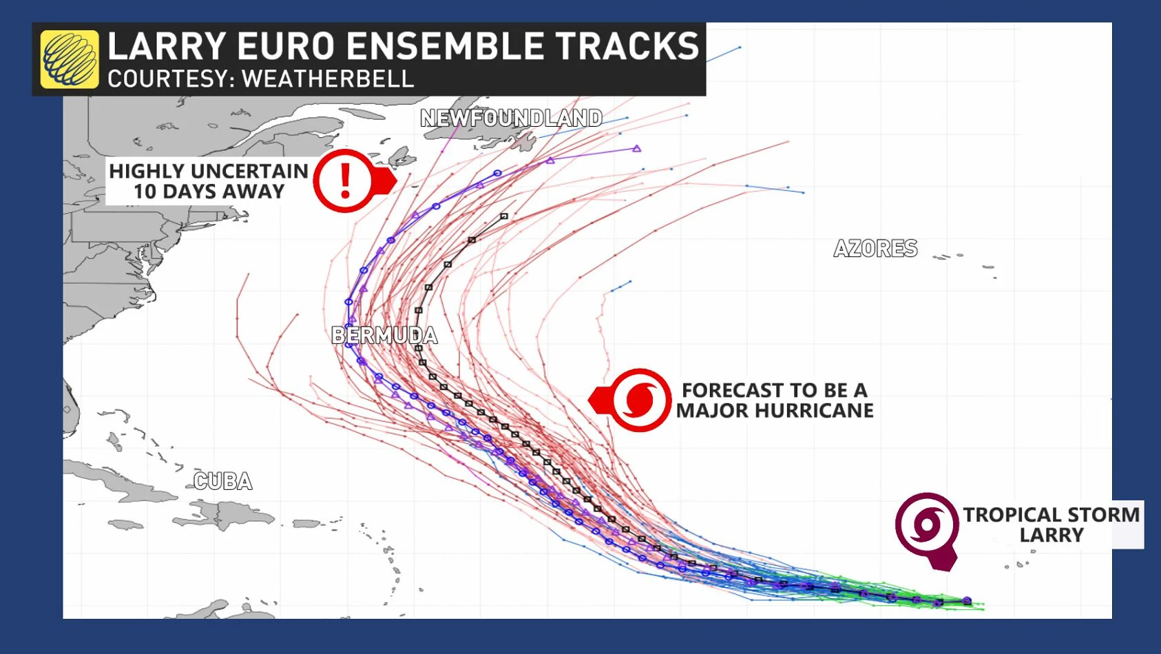
Its ultimate impact on Atlantic Canada is, however, highly uncertain, given that it isn't expected to approach the region until late next week. However, forecasters say it's best to watch the storm's progress.
"For Atlantic Canadians, there is no need to worry right now. But check in daily and start paying closer attention this weekend and early next week to the forecast," Weather Network Chief Meteorologist Chris Scott says. "If you're in emergency management or are responsible for weather-related job decisions, this is one to watch."
The most likely scenario is for Larry to recurve out to sea and just clip southeastern Newfoundland. However, there are some computer models that show a risk for Larry’s track to be close enough to bring strong winds and heavy rain to parts of Newfoundland, especially the Avalon.
IN PHOTOS: IDA REMNANTS BRING FLOODING RAINS TO THE MARITIMES
Be sure to check back for the latest updates on the active Atlantic hurricane season and its impacts across the East Coast.
Thumbnail image courtesy: John Morris