Active AlertsKelsey, Division No. 22, MB
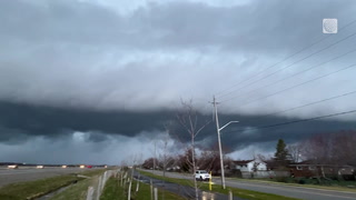
Significant rain and snow on the way, beginning Tuesday morning and continuing through Thursday.
A large, slow moving low pressure system will begin to impact northern Manitoba on Tuesday. Precipitation is expected to begin as rain Tuesday and transition to snow for most areas on Wednesday. After this transition, the snow will continue until late Thursday.
There is the potential for notable rainfall and snowfall amounts with 20 to 40 mm of total precipitation expected for the three day period. While there is growing certainty as to an overall area of these higher amounts, it is less certain when rain will give way to accumulating snow. This will greatly impact individual rainfall and snowfall amounts.
Current indications show more northerly communities such as Lynn Lake and Thompson are more likely to receive mainly snow, while further south toward The Pas and Norway House the event will begin as accumulating rain and shift towards snow as the event progresses.
###
Please continue to monitor alerts and forecasts issued by Environment Canada. To report severe weather, send an email to MBstorm@ec.gc.ca or tweet reports using #MBStorm.