Pesky low brings more snow to NFLD. Here's how much
Digital Reporter
Sunday, November 15, 2015, 4:19 PM - After a dismal weekend, the slushy mess continues in Newfoundland.
A stalled low and northerly winds will help transition rain into more snow over northeastern portions of the island Sunday evening into Monday. Accumulations could top 15 cm in some areas, according to Environment Canada.
Snowfall warnings are in place for places including, Gander, Terra Nova and Grand Falls.
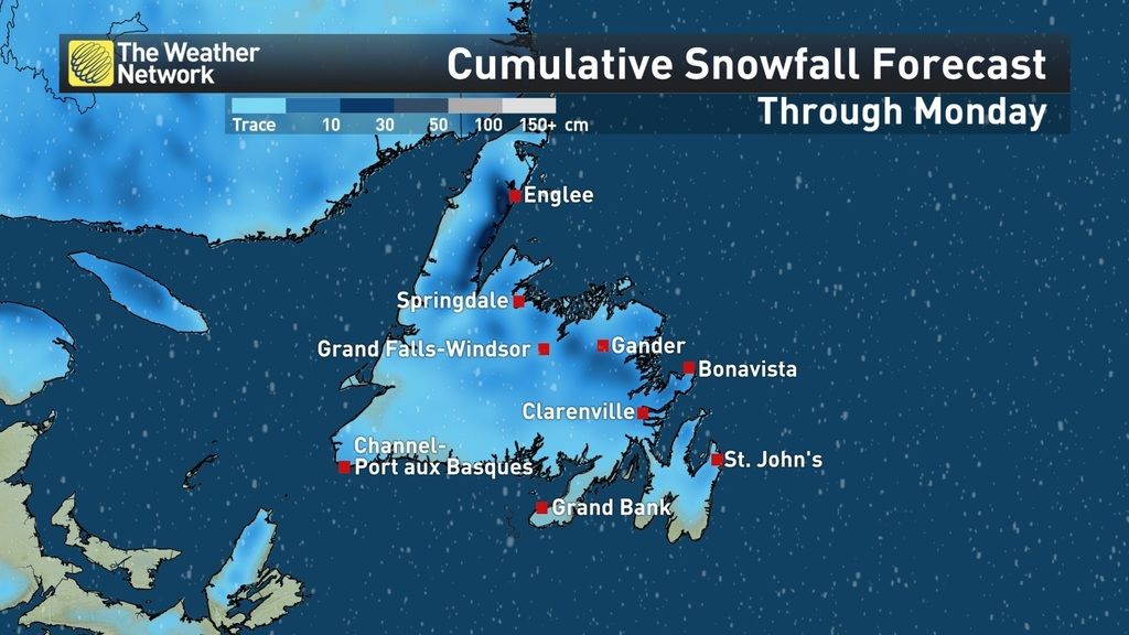
While temperatures are expected to hover around the freezing mark, slippery conditions and poor visibility could become an issue on the roads, especially for places along the coast.
In addition to the snow, residents can expect winds to be relentless, gusting up to 50 to 60 km/h.
Gander picked up about 20 mm of rain Saturday. Meanwhile, St. John's saw 24 mm. The rain transitioned into snow for areas like Gander Sunday morning.
The snow will taper off as the system is expected to depart Monday evening into Tuesday morning.
Tune into The Weather Network on TV for continued updates on this system.