Flurries, snow squalls headed to Ontario
Digital Reporter
Wednesday, November 18, 2015, 8:18 PM - Special weather statements are in effect for parts of southern Ontario ahead of snow squalls and flurries that are expected to move in late Thursday evening.
Squalls will develop off of Georgian Bay. Lake enhancement is also possible.
"Snowfall totals are still to be determined but the most probable locations for accumulating snow will be the highest elevations in southwestern Ontario as well as cottage country," says Weather Network meteorologist Erin Wenckstern.
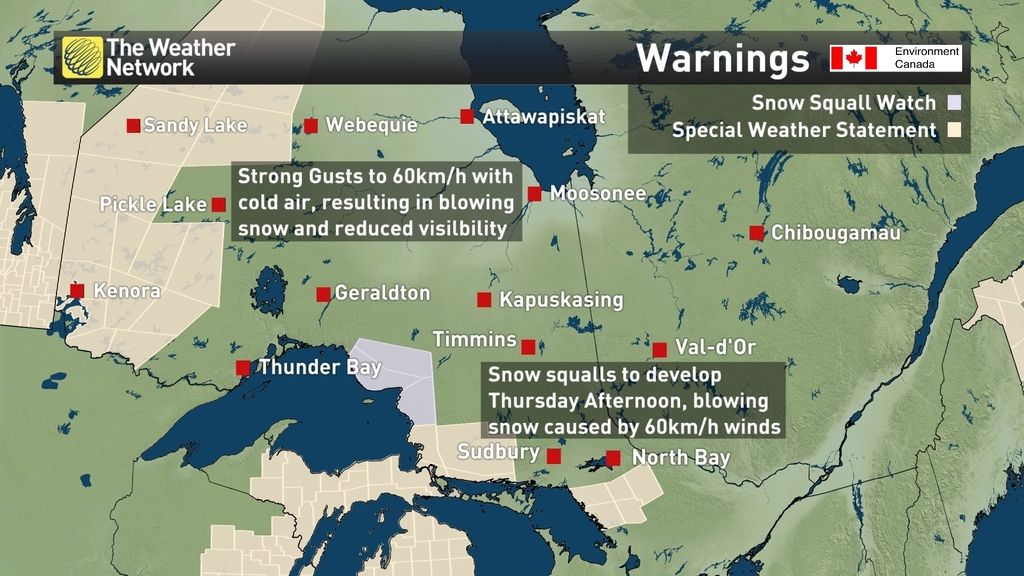
"Showers are forecast to change to flurries and local snow squalls Thursday night as temperatures drop behind a cold front," Environment Canada says in a statement.
"Although significant accumulations are not expected at this time, heavy flurries and local blowing snow could reduce visibilities. Travellers should prepare for winter driving conditions."
Flurries possible in the GTA this weekend
Daytime highs will hover near the freezing mark in the Toronto area Saturday into Sunday, elevating the risk of wet flurries.
Wenckstern says some communities could see spots of snow which will likely changeover to rain.


