Experts predict an extremely active 2024 Atlantic hurricane season
The prediction of near-record activity arrives amid worrying conditions across the ocean basin
This year’s Atlantic hurricane season could be one of the most active ever recorded, a team of experts at Colorado State University warned on Thursday.
Forecasters pointed to multiple factors that could work together to dramatically boost tropical cyclone formation across the ocean basin, including historically warm ocean temperatures and an impending La Niña.
Meteorologists widely hold CSU’s seasonal outlooks in high regard because of the team’s accuracy in identifying the factors that are likely to influence tropical cyclone activity across the Atlantic basin.
“As with all hurricane seasons, coastal residents are reminded that it only takes one hurricane making landfall to make it an active season,” the CSU team added. “Thorough preparations should be made every season, regardless of predicted activity.”
DON’T MISS: Atlantic ‘hurricane alley’ sees ominous mid-July heat in February
Experts call for a potentially record-setting season this year
A normal hurricane season in the Atlantic Ocean produces about 14 named tropical storms. Seven of those named storms typically grow into hurricanes, three of which strengthen into major hurricanes with winds of about 180 km/h or stronger.

Colorado State University’s initial outlook calls for about 23 named tropical storms this year, including 11 hurricanes and five major hurricanes.
If the prediction comes to pass, this would make for one of the most active Atlantic hurricane seasons ever observed behind 2020, 2005, and 2021.

Overall storm intensity could rival historic years
The raw number of named storms doesn’t tell the whole story. Meteorologists commonly use Accumulated Cyclone Energy (ACE) to calculate the true intensity of a hurricane season. ACE accounts for the intensity and longevity of each tropical system added together.
RELATED: How hot water fuels the world’s most powerful hurricanes

A tropical storm that only survives for 12 hours is far different from a major hurricane that churns over the ocean for 14 days. Even though they each count as one named storm, the major hurricane would generate a significantly higher ACE than the short-lived tropical storm.
Forecasters expect this year’s storm activity to generate an ACE of about 210, which would place 2024 near the upper end of all hurricane seasons since records began in 1851. An average Atlantic hurricane season generates an ACE of about 123.
The highest ACE generated by a season in the modern era was 245 during the powerhouse 2005 season.
WATCH: The best time to prepare for a hurricane is now. Here's how
Favourable conditions coming together in the Atlantic
Tropical cyclones are powerful but fragile systems. They require just the right balance of ingredients in order to develop and thrive. The main ingredients include warm ocean waters, low wind shear, moist air, and robust thunderstorms.
The Atlantic Ocean has been running a fever for more than a year now. Average sea surface temperatures across the basin are warmer than we’ve ever measured in the past, measuring as warm in February as they typically are in July.
Forecasters see no sign of that warmth abating anytime soon. “Overall, the current [sea surface temperature] anomaly pattern correlates very well with what is typically seen in active Atlantic hurricane seasons,” the CSU team said in their outlook.

MUST SEE: How a mammoth hurricane rapidly intensifies in mere hours
Another significant factor likely to drive this year’s hurricane season is the development of La Niña next door in the eastern Pacific Ocean.
La Niña's cooler waters can decrease the amount of wind shear blowing over the Atlantic Ocean, which makes conditions more favourable for the development of tropical cyclones. Lower wind shear affords tropical disturbances more opportunities to take hold and develop into full-fledged storms.
What happens if we exhaust the list of names again?
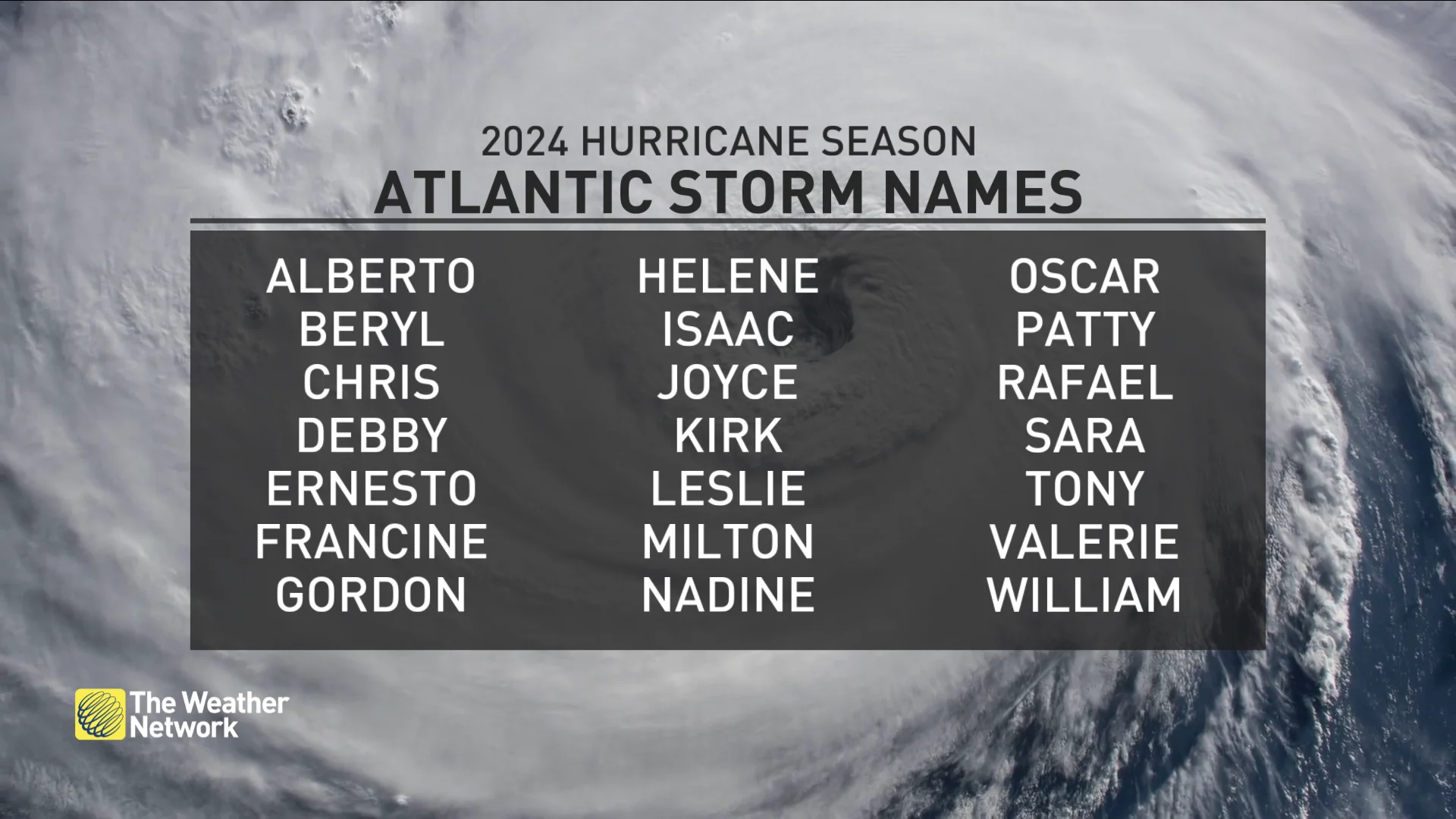
Forecasters name tropical systems in the Atlantic basin using alphabetical lists that repeat every six years. The list for 2024 was last used in 2018. This year’s list includes new entries in Francine and Milton. These names replace Florence and Michael, which were retired after the 2018 season.

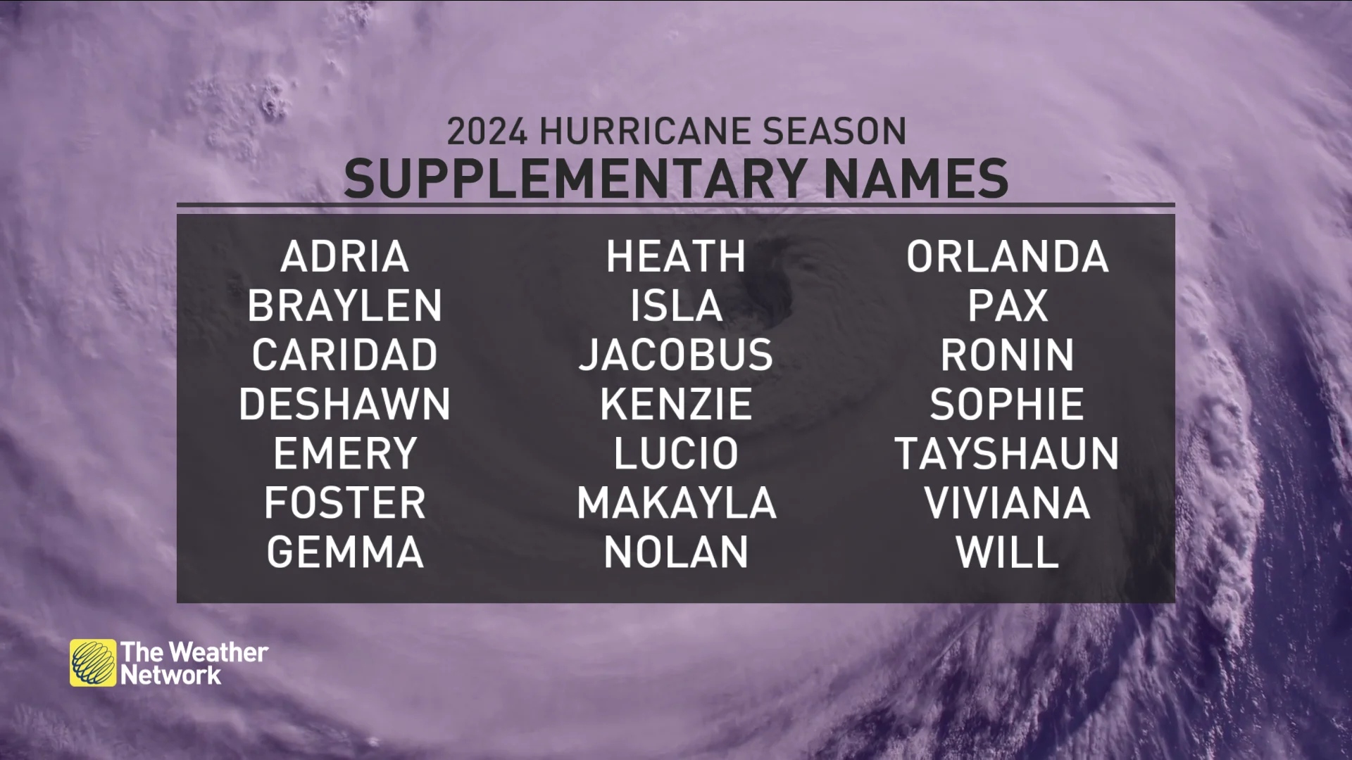
There is a backup plan in place if we exhaust the list with 22 or more storms in a single season. Previously, the Greek alphabet served as a fallback if we ran out of names. This only happened in 2005 and 2020.
After 2020, the World Meteorological Organization (WMO) instead developed an auxiliary list of names to be used if we exhaust a season's primary list.
The Atlantic’s supplementary list follows the same familiar format, beginning with Adria and ending with Will. Each name on the spare list could be easily replaced if needed.
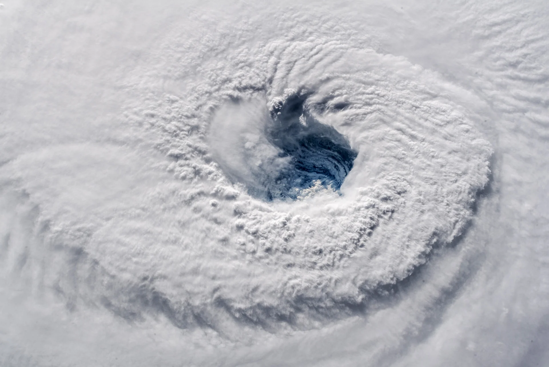
Header image courtesy of NASA.
Follow Dennis Mersereau on the X platform, formerly known as Twitter.


