
Eastern Canada braces for heavy rainfall, ice amid threat of flooding
A sizable portion of Eastern Canada will be hit with impactful weather in the days ahead, with freezing rain and a prolonged stretch of heavy rainfall for different areas –– elevating the risk of power outages and flooding.
This week will see a complex storm bring a mix of wintry and spring impacts to a good portion of Quebec and the East Coast.
Following an icy system that cut through the northern Maritimes Wednesday, a boundary has established itself over New Brunswick and western Nova Scotia. This boundary will serve as a conduit for moisture to stream over the region in the days ahead.
RELATED: Storm washes out roads, leaves thousands in New Brunswick without power
The Maritimes are gearing up for an extended bout of wet weather, as bands of heavy rain continue to sweep across the region, intensifying through Thursday morning and persisting well into the weekend.
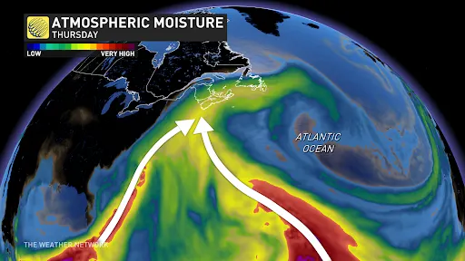
The precipitation, stemming from two potent moisture streams - one originating from the tropics and the other from the Gulf of Mexico - is set to collide over Atlantic Canada, unleashing a deluge of rain and potentially disruptive weather conditions.
Forecasters are warning residents to prepare for persistent rainfall, which is expected to linger over the same areas for several days.
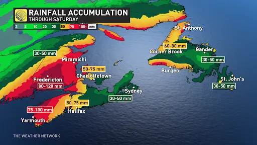
The heaviest activity is projected to hit regions near the Bay of Fundy and parts of southwestern Nova Scotia, with approximate rainfall totals ranging between 50 to 120 mm.
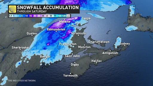
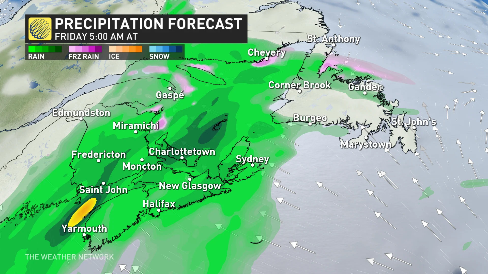
Wet weather stretches across Atlantic Canada Friday
As the weekend approaches, the wet weather is anticipated to spread its reach across the entirety of Atlantic Canada on Friday and Saturday.
For New Brunswick, there is a chance of spring snowfall late Friday into Saturday.
This mixed bag of weather is carrying with it some considerable risks.
Localized power outages are a threat in areas experiencing heavier rainfall and gusty winds. Roadways can also become dangerous with ponding and pooling posing hazards to motorists, and saturated soil brings concerns of landslides..
DON'T MISS: Eclipse viewing parties in Quebec are coming to a path of totality near you
Risk for flooding
It should be noted that the placement of heaviest rain totals could shift, but certainty is increasing for rising river levels, which could come close to hitting the flood stage in some areas.
There's a heightened flood concern across Nova Scotia and southern New Brunswick, especially with unstable soils from recent rains and high moisture.
An important area to watch for potential flooding is around the lower Saint John River. Due to ice jams and their unpredictable nature, it's hard to tell what the river levels will be like between Perth-Andover and Woodstock with this rainfall event.
River levels are forecast to reach a critical threshold around Nashwaak and Durham Bridge in the coming days, so be sure to regularly check for public alerts and advisories if you are in this area.
Localized flooding is also possible in areas with poor drainage. As well, there is a good chance of ponding or pooling on the roadways, so be aware if you're planning on travelling. Remember to never drive through flooded or washed-out roadways, as this could cause your vehicle to stall and put you in a dangerous situation.
A band of significant snow is expected to develop on the back side of the storm, possibly impacting eastern Quebec and parts of the Maritimes, though the track of the system and its exact impacts are still uncertain.
Conditions will remain blustery and cool, with yet another system eyeing the region for the middle of next week.
WATCH BELOW: New pilot program uses batteries to keep power on during a storm
Be sure to check back for the latest updates across Eastern Canada this week.


