Stalling system brings flood, travel concerns to the eastern Prairies
A sprawling, sluggish spring storm will continue to meander across the eastern Prairies Wednesday, with hefty snowfall totals and heavy rainfall expected to bring hazardous travel and potential flooding for some areas
April is showing the Prairies why it is such a transitional month.
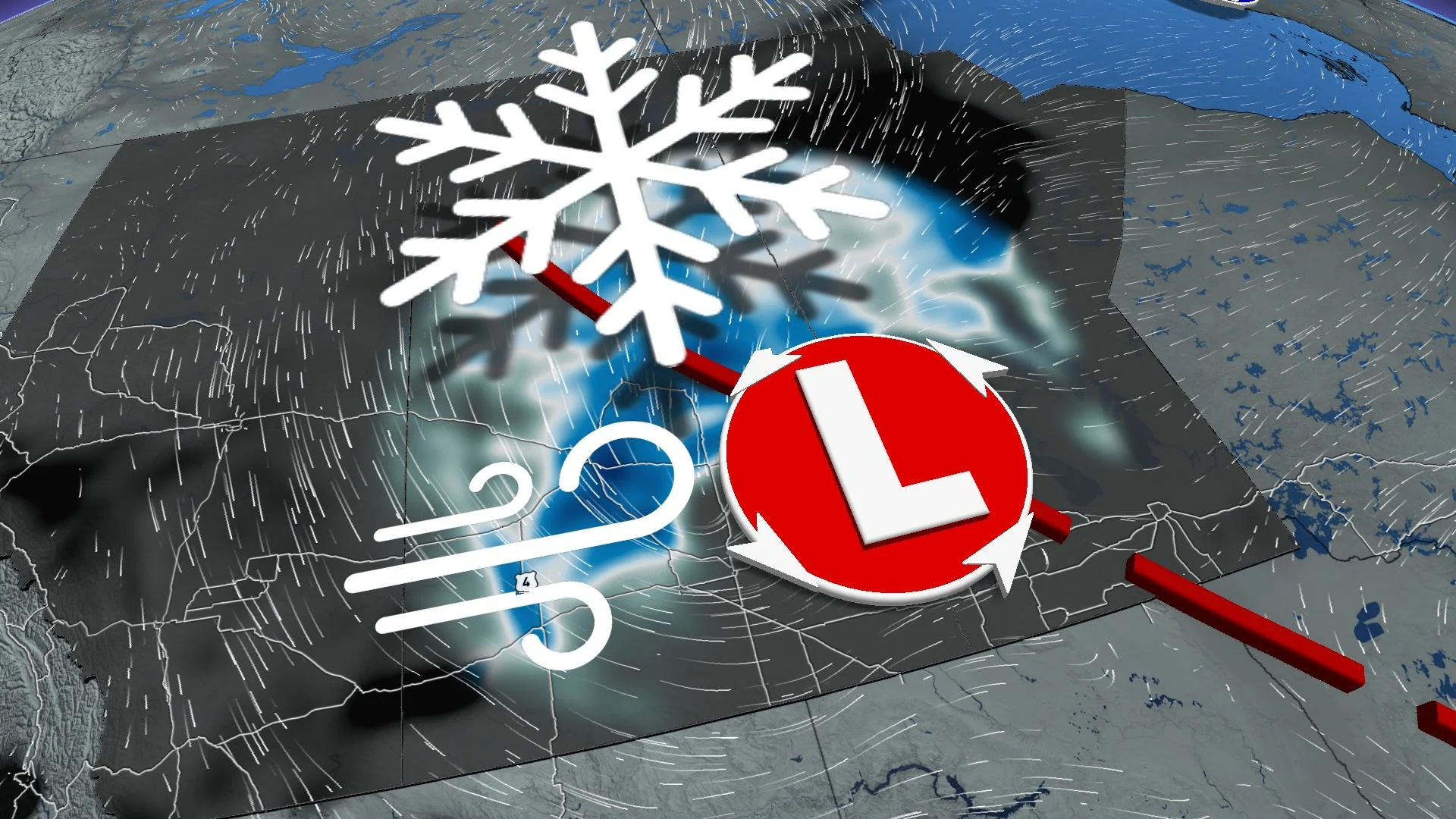
All three Prairie provinces have been dealt a wintry blow this month, with Saskatchewan and Manitoba seeing the peak of a spring storm on Wednesday, loaded with snow and rainfall.
MUST SEE: No April fool: Almost every province could see snow this week
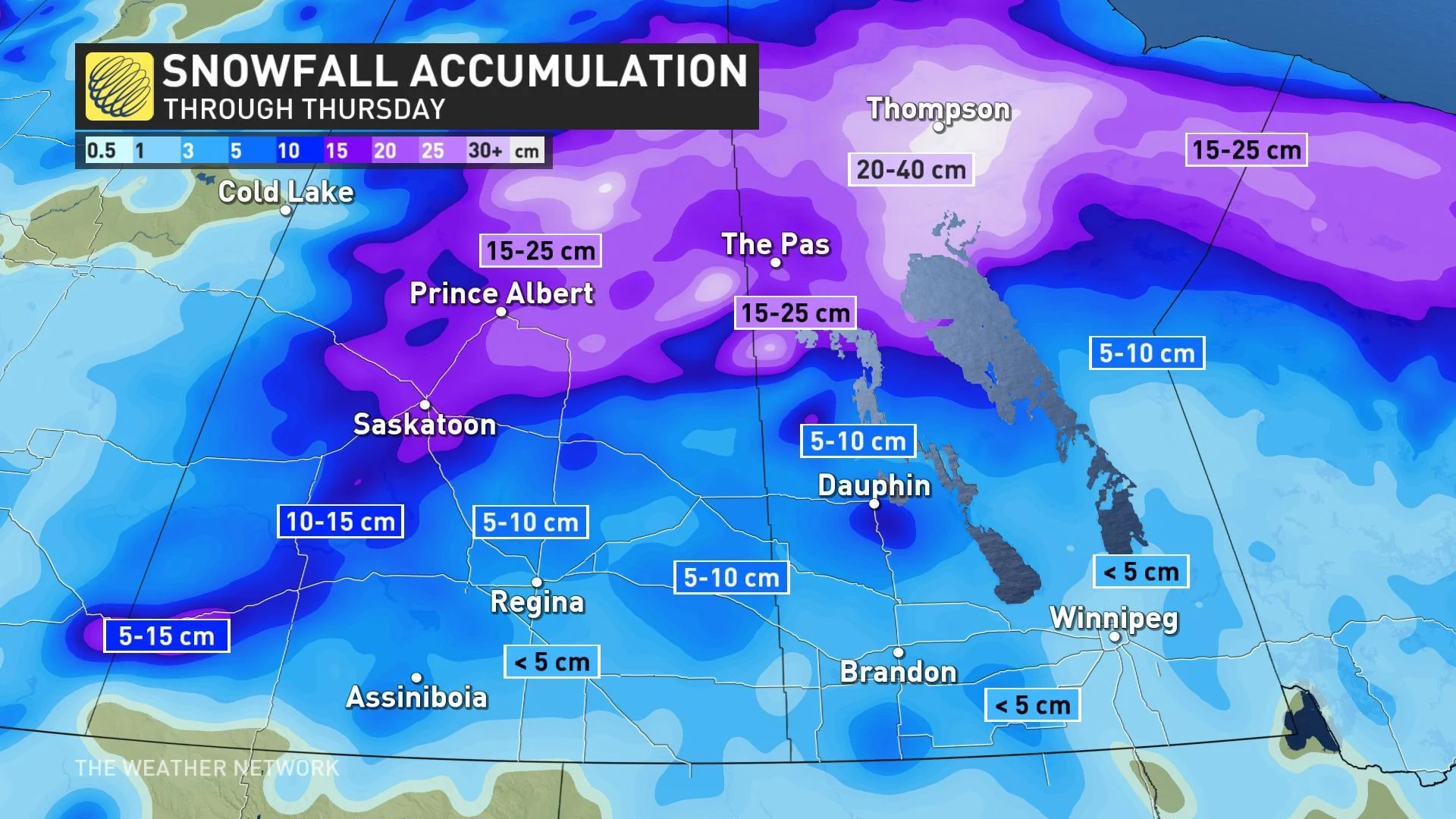
By the time all is said and done, central and northern Saskatchewan, as well as parts of Manitoba, are in line to potentially see 10-30+ cm of snow.
Visibility may be suddenly reduced at times in heavy snow. Consider postponing non-essential travel until conditions improve. Drivers will be wise to avoid the Trans-Canada and Yellowhead highways, especially, as gusty winds threaten periods of whiteout conditions.
For southern Manitoba, the additional precipitation is of concern for rivers and streams. With previously melting snow and soaking rains, a provincial flood warning was issued for some areas, including the Assiniboine River.
Wednesday: Travel troubles likely, flood risk rises with multi-day snow setup
Due to its stationary position, a stalled system will bring significant snowfall to parts of the eastern Prairies and heavy rain to southern Manitoba, raising flood concerns for Brandon’s Assiniboine River.
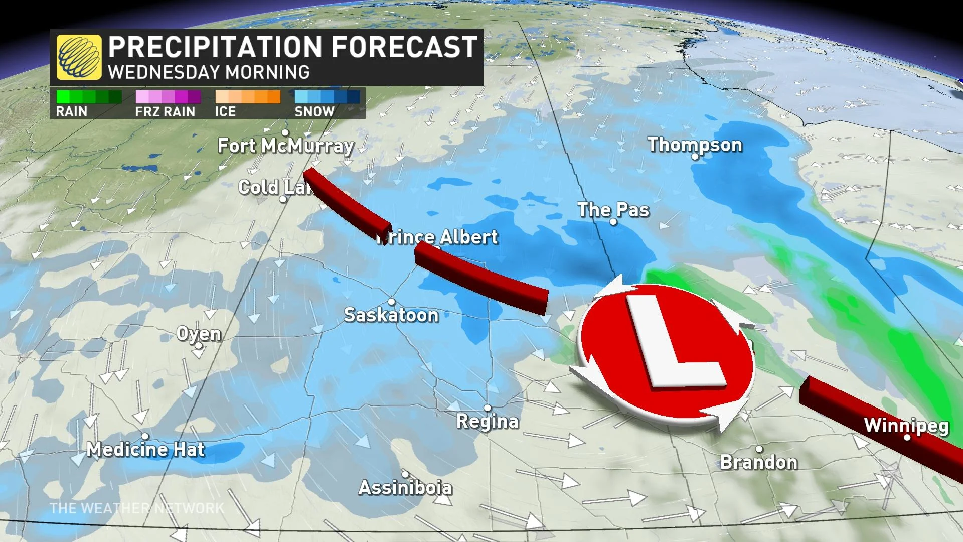
While parts of central Saskatchewan and northern Manitoba may see some wet snow falling Wednesday morning, which will continue for much of the day in northern Manitoba. Meanwhile, cold, northerly air will quickly move in and settle over Saskatchewan, blanketing the province in fluffy snowfall.
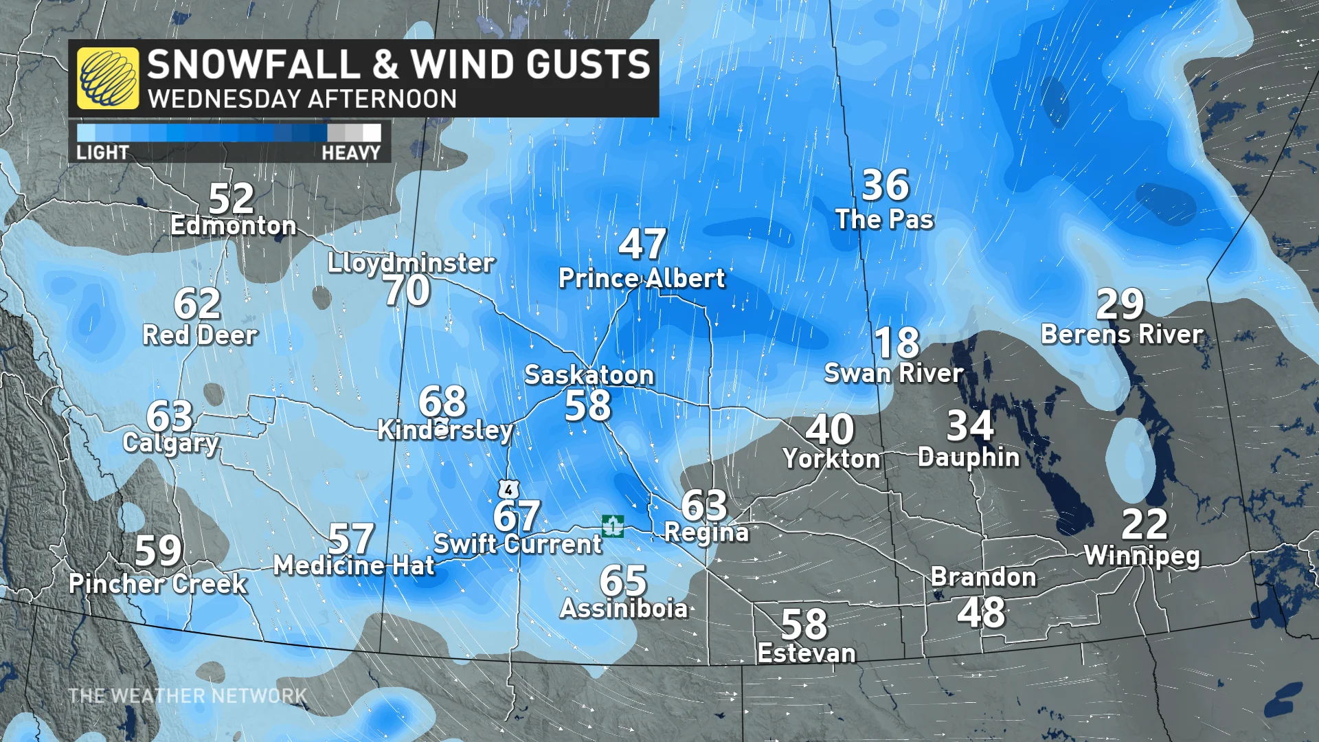
Winds will be strong, as well, gusting to 60+ km/h across Saskatchewan on Wednesday afternoon.
While snowfall totals are still somewhat uncertain and could greatly vary, between 10-30+ cm is possible over the three-day period. The highest totals will likely fall near Thompson, Man.
Forecasters will be watching for the transition to wet snow for areas including Saskatoon, Regina and Yorkton, Sask., with subtle changes in temperature and the track of the system influencing overall totals.
SEE ALSO: How Omega blocks and Rex blocks can affect Canada's weather
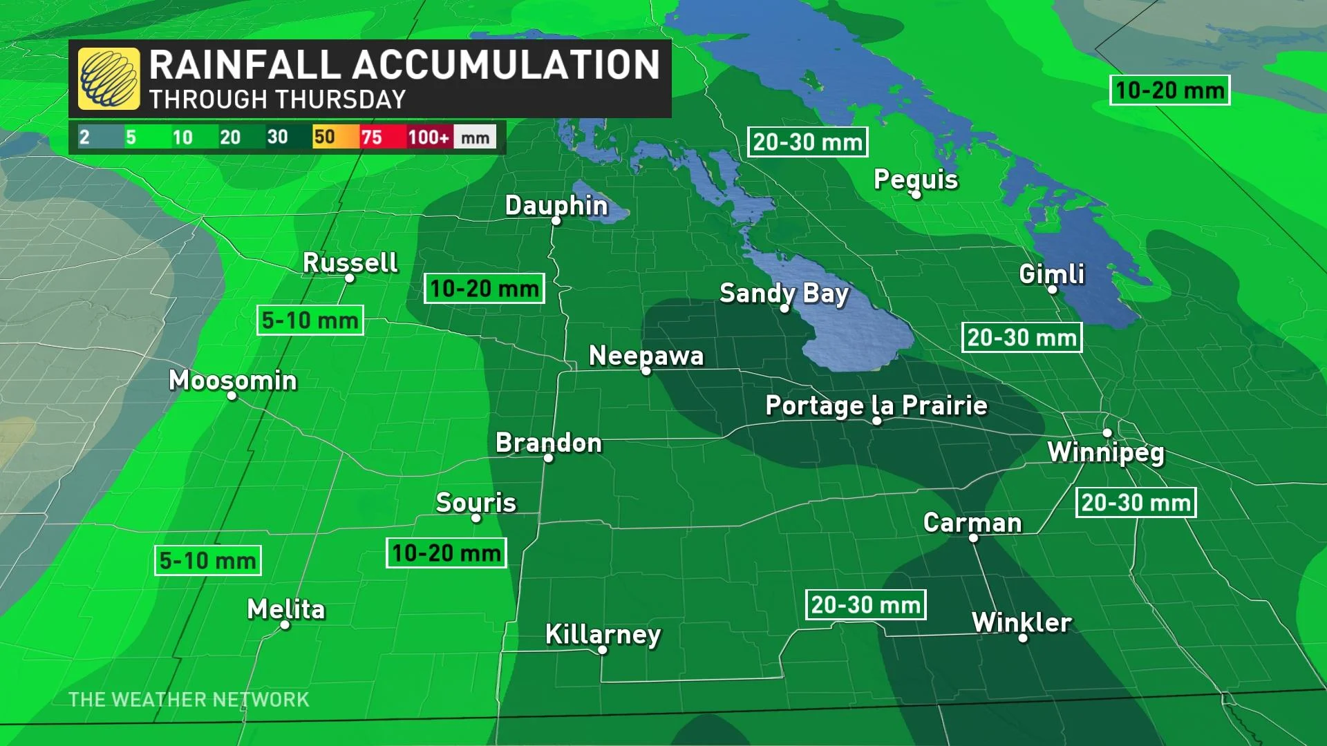
The snow will spread into southern Manitoba by Thursday morning, though with much less amounts, with approximately 5 cm likely in the Winnipeg area.
Drivers are urged to plan ahead for the changing conditions, with travel disruptions likely amid the gusty winds and snow. Areas northeast of Prince Albert, Sask., across the Thompson region in Manitoba, and along the Trans-Canada and Yellowhead highways are expected to see treacherous travelling conditions.
Rising flood concerns with recent snowmelt and incoming rain
Rainfall totals won't be overly excessive in southern Manitoba, either, but with the recent rapid snowmelt and additional precipitation, flood forecasters are on alert.
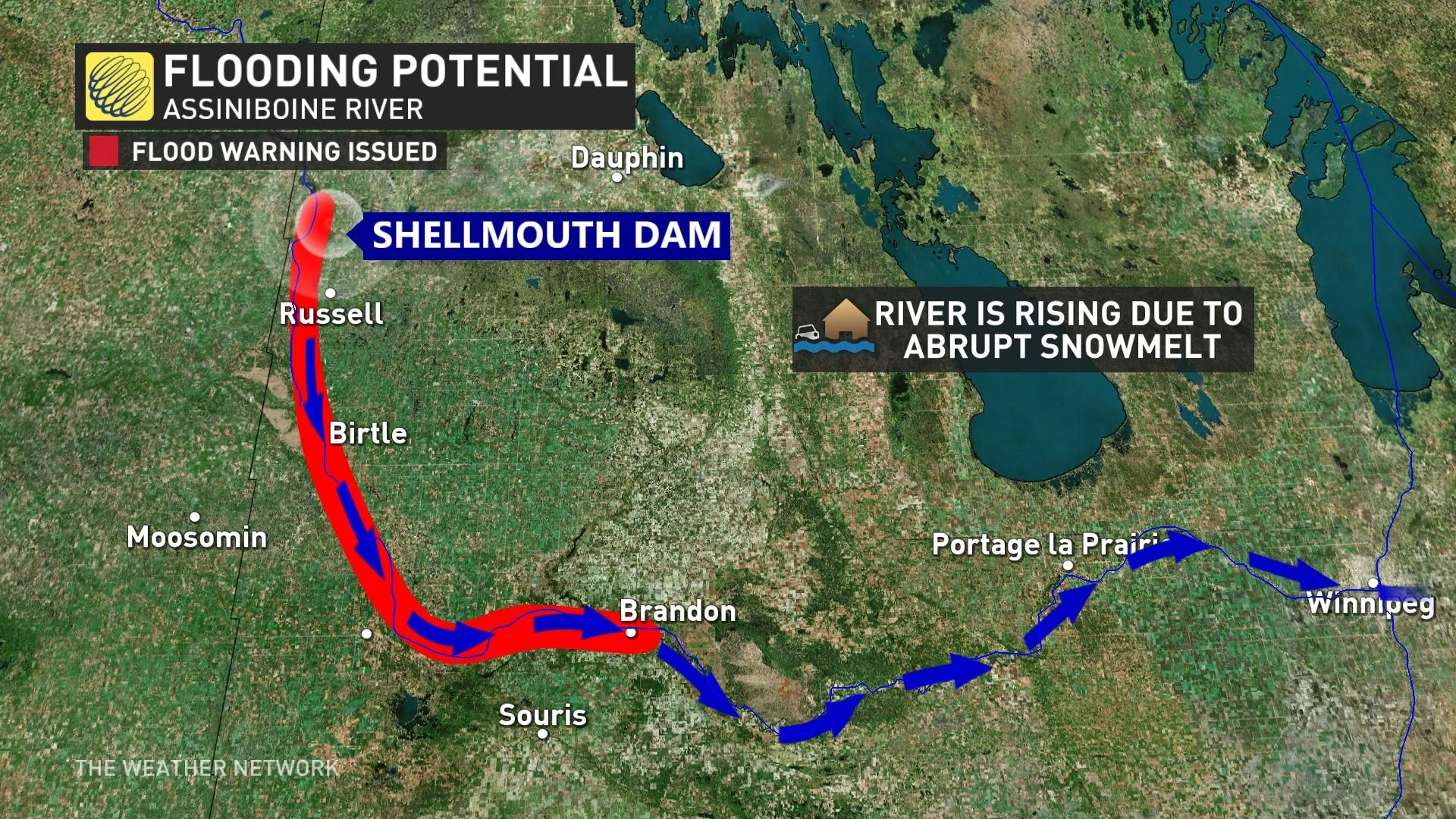
Persistent rain is expected to continue in southern Manitoba through Wednesday, increasing the water levels on the Assiniboine River –– from Russel to Brandon.
Late last week, a flood warning was issued for the Assiniboine River, between the Shellmouth Dam and the city of Brandon.
"A flood warning has been issued for these areas as the rising water levels could impact low-lying areas," a Friday news release from the province said. "The Assiniboine River is expected to be within the banks in the third week of April."
LEARN MORE: Flood warning issued for Assiniboine River near Brandon
As the melt continues and precipitation moves in, river flows and levels are expected to fluctuate in the coming days.
Manitobans are urged to stay off the weak ice and take caution around water systems, as conditions can change rapidly and without warning.
Stay with The Weather Network for all the latest on this snowstorm across the Prairies.


