Active AlertsPine Hills Golf Course, WI
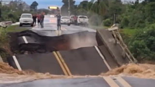
If outdoors, consider seeking shelter inside a building.Torrential rainfall is also occurring with these storms and may leadto localized flooding. Do not drive your vehicle through floodedroadways.
At 529 PM CDT, Doppler radar was tracking strong thunderstorms alonga line extending from 6 miles southeast of Navarino Wildlife Area to9 miles north of Little Chute to near Darboy. Movement was northeastat 30 mph.HAZARD...Wind gusts up to 40 mph and pea size hail.SOURCE...Radar indicated.IMPACT...Gusty winds could knock down tree limbs and blow aroundunsecured objects. Minor hail damage to vegetation ispossible.Strong thunderstorms will be near...Green Bay and Pulaski around 540 PM CDT.Other locations impacted by these storms include Maribel, Wayside,Morrison, Rose Lawn, Humboldt, Freedom, Ledgeview, Leo Frigo Bridge,Askeaton, and Howard.