Active AlertsKenefick, TX
Turn around, don't drown when encountering flooded roads. Most flooddeaths occur in vehicles.Motorists should not attempt to drive around barricades or drivecars through flooded areas.Please report observed flooding to local emergency services or lawenforcement and request they pass this information to the NationalWeather Service when you can do so safely.Additional information is available at www.weather.gov/hgx.The next statement will be issued late tonight at 430 AM CDT.
...Forecast flooding changed from Minor to Moderate severity andincreased in duration for the following rivers in Texas...East Fork San Jacinto near New Caney affecting Harris, Montgomeryand Liberty Counties.For the East Fork San Jacinto River...including New Caney...Moderateflooding is forecast.* WHAT...Minor flooding is occurring and moderate flooding isforecast.* WHERE...East Fork San Jacinto near New Caney.* WHEN...Until further notice.* IMPACTS...At 58.0 feet, Minor lowland flooding begins in thevicinity of the gage with minor roads such as Chinquapin andRiverside Roads beginning to flood.At 62.0 feet, Moderate lowland flooding begins with secondaryroads near the river inundated, including FM 1485 west of theriver.* ADDITIONAL DETAILS...- At 10:00 AM CDT Thursday the stage was 59.1 feet.- Bankfull stage is 54.5 feet.- Recent Activity...The maximum river stage in the 24 hoursending at 10:00 AM CDT Thursday was 61.5 feet.- Forecast...The river is expected to rise above flood stagetomorrow afternoon and continue rising to a crest of 65.2feet Sunday afternoon.- Flood stage is 58.0 feet.- Flood History...This crest compares to a previous crest of64.8 feet on 10/21/1998.- http://www.weather.gov/safety/flood
You should monitor later forecasts and be alert for possible FloodWarnings. Those living in areas prone to flooding should be preparedto take action should flooding develop.
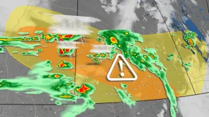
* WHAT...Flooding caused by excessive rainfall continues to bepossible.* WHERE...A portion of southeast Texas, including the followingareas, Austin, Brazos, Burleson, Coastal Harris, Grimes, Houston,Inland Harris, Madison, Montgomery, Northern Liberty, Polk, SanJacinto, Southern Liberty, Trinity, Walker, Waller and Washington.* WHEN...Through Friday morning.* IMPACTS...Excessive runoff may result in flooding of rivers,creeks, streams, and other low-lying and flood-prone locations.* ADDITIONAL DETAILS...- Widespread thunderstorms will develop across the area thisafternoon and evening, with the presence of a warm frontalboundary and abundant moisture providing favorable conditionsfor heavy rainfall. The flood threat will be furtherexacerbated by well-saturated soils still present acrossportions of the region due to significant antecedentrainfall. In general, 3-6" of new rainfall can be expectedfor areas north of the I-10 corridor through this evening.Isolated locally higher totals are possible as well. This mayresult in street flooding, as well as rises along area riversand creeks.- http://www.weather.gov/safety/flood
Please report observed flooding to local emergency services or lawenforcement and request they pass this information to the NationalWeather Service when you can do so safely.Turn around, don't drown when encountering flooded roads. Most flooddeaths occur in vehicles.Motorists should not attempt to drive around barricades or drivecars through flooded areas.Additional information is available at www.weather.gov/hgx.The next statement will be issued late tonight at 430 AM CDT.
...The Flood Warning continues for the following rivers in Texas...Trinity River near Moss Bluff affecting Chambers and LibertyCounties.For the Trinity River...including Crockett, Riverside, Romayor,Goodrich, Liberty, Moss Bluff...Major flooding is forecast.* WHAT...Moderate flooding is occurring and moderate flooding isforecast.* WHERE...Trinity River near Moss Bluff.* WHEN...Until further notice.* IMPACTS...At 15.2 feet, Moderate lowland flooding begins in thevicinity of the gage.* ADDITIONAL DETAILS...- At 9:30 AM CDT Thursday the stage was 15.4 feet.- Bankfull stage is 9.2 feet.- Recent Activity...The maximum river stage in the 24 hoursending at 9:30 AM CDT Thursday was 15.6 feet.- Forecast...The river is expected to fall to 15.4 feet Tuesdaymorning.- Flood stage is 12.2 feet.- Flood History...This crest compares to a previous crest of15.2 feet on 06/03/2016.- http://www.weather.gov/safety/flood