Active AlertsHartsburg, TX
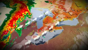
...The Flood Warning is extended for the following rivers in Texas...Louisiana...Sabine River Near Burkeville...The Flood Warning continues for the following rivers in Texas...Louisiana...Pine Island Bayou Near Sour LakeSabine River Near Bon WierSabine River Near DeweyvilleNeches River Near EvadaleNeches River Near Town BluffNeches River at Neches River Saltwater BarrierVillage Creek Near KountzeAdditional information is available at www.weather.gov.The next statement will be issued Monday evening at 1000 PM CDT.* WHAT...Moderate flooding is occurring and moderate flooding isforecast.* WHERE...Sabine River near Bon Wier.* WHEN...Until further notice.* IMPACTS...At 35.0 feet, Expect several secondary roads in theMerryville and Bon Wier areas near the river to be closed.* ADDITIONAL DETAILS...- At 9:15 PM CDT Sunday the stage was 34.6 feet.- Recent Activity...The maximum river stage in the 24 hoursending at 9:15 PM CDT Sunday was 34.8 feet.- Forecast...The river is expected to slowly fall but remainabove flood stage for the next several days.- Flood stage is 30.0 feet.- http://www.weather.gov/safety/flood
...The Flood Warning is extended for the following rivers in Texas...Louisiana...Sabine River Near Burkeville...The Flood Warning continues for the following rivers in Texas...Louisiana...Pine Island Bayou Near Sour LakeSabine River Near Bon WierSabine River Near DeweyvilleNeches River Near EvadaleNeches River Near Town BluffNeches River at Neches River Saltwater BarrierVillage Creek Near KountzeAdditional information is available at www.weather.gov.The next statement will be issued Monday evening at 1000 PM CDT.* WHAT...Minor flooding is occurring and minor flooding is forecast.* WHERE...Sabine River near Burkeville.* WHEN...Until early Wednesday morning.* IMPACTS...At 36.0 feet, Residential flooding in the River BendSubdivision occurs.* ADDITIONAL DETAILS...- At 9:15 PM CDT Sunday the stage was 36.9 feet.- Recent Activity...The maximum river stage in the 24 hoursending at 9:15 PM CDT Sunday was 37.0 feet.- Forecast...The river is expected to slowly fall over the nextfew days, and is expected to fall below flood stage earlyTuesday afternoon and continue falling to 31.4 feet Fridayevening.- Flood stage is 36.0 feet.- http://www.weather.gov/safety/flood