Active AlertsMercer, NE
THE NATIONAL WEATHER SERVICE HAS ISSUED SEVERE THUNDERSTORM WATCH274 UNTIL 7 AM CDT TUESDAY WHICH REPLACES A PORTION OF SEVERETHUNDERSTORM WATCH 271. THE NEW WATCH IS VALID FOR THE FOLLOWINGAREASIN IOWA THE NEW WATCH INCLUDES 4 COUNTIESIN SOUTHWEST IOWAHARRISON POTTAWATTAMIE SHELBYIN WEST CENTRAL IOWAMONONAIN NEBRASKA THE NEW WATCH INCLUDES 22 COUNTIESIN EAST CENTRAL NEBRASKABURT BUTLER DODGEDOUGLAS SARPY SAUNDERSWASHINGTONIN NORTHEAST NEBRASKABOONE COLFAX CUMINGMADISON PLATTE STANTONTHURSTONIN SOUTHEAST NEBRASKACASS GAGE JEFFERSONJOHNSON LANCASTER OTOESALINE SEWARDTHIS INCLUDES THE CITIES OF ALBION, ASHLAND, BEATRICE, BELLEVUE,BLAIR, COLUMBUS, COUNCIL BLUFFS, CRETE, DAVID CITY, DECATUR,DUNLAP, FAIRBURY, FREMONT, HARLAN, LA VISTA, LINCOLN, LOGAN,LYONS, MACY, MAPLETON, MILFORD, MISSOURI VALLEY, NEBRASKA CITY,NORFOLK, OAKLAND, OMAHA, ONAWA, PAPILLION, PENDER, PLATTSMOUTH,SCHUYLER, SEWARD, ST. EDWARD, STANTON, STERLING, TECUMSEH,TEKAMAH, WAHOO, WALTHILL, WEST POINT, WILBER, WINNEBAGO, WISNER,WOODBINE, AND YUTAN.
You should monitor later forecasts and be alert for possible FloodWarnings. Those living in areas prone to flooding should be preparedto take action should flooding develop.
* WHAT...Flooding caused by excessive rainfall continues to bepossible.* WHERE...Portions of Iowa, including the following counties,Fremont, Harrison, Mills, Monona, Montgomery, Page, Pottawattamieand Shelby and Nebraska, including the following counties, Burt,Butler, Cass, Colfax, Cuming, Dodge, Douglas, Lancaster, Otoe,Platte, Saline, Sarpy, Saunders, Seward, Thurston and Washington.* WHEN...Through this evening.* IMPACTS...Excessive runoff may result in flooding of rivers,creeks, streams, and other low-lying and flood-prone locations.* ADDITIONAL DETAILS...- Thunderstorms will continue through the morning hours beforeending by early afternoon.- http://www.weather.gov/safety/flood
For your protection move to an interior room on the lowest floor of abuilding.
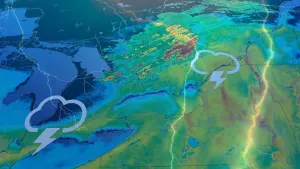
At 519 AM CDT, severe thunderstorms were located along a lineextending from 3 miles east of Fort Calhoun to 4 miles north ofCeresco, moving east at 20 mph.HAZARD...Quarter size hail.SOURCE...Trained weather spotters.IMPACT...Damage to vehicles is expected.Locations impacted include...Omaha, northern Council Bluffs, Bennington, Boys Town, Elkhorn,Carter Lake, Missouri Valley, Valley, Arlington, Yutan, Fort Calhoun,Waterloo, Crescent, Mead, Kennard, Leshara, Florence, Zorinsky Lake,Midtown, and Benson.