Active AlertsLingle, MS
You should monitor later forecasts and be prepared to take actionshould Flash Flood Warnings be issued.
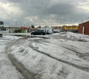
* WHAT...Flash flooding caused by excessive rainfall continues to bepossible.* WHERE...Portions of northeast Louisiana, including the followingparishes, Catahoula and Concordia and Mississippi, including thefollowing areas, Adams, Clarke, Copiah, Covington, Forrest,Franklin MS, Jasper, Jefferson, Jefferson Davis, Jones, Lamar,Lauderdale, Lawrence, Lincoln, Marion, Newton, Rankin, Scott,Simpson and Smith.* WHEN...Through Saturday morning.* IMPACTS...Excessive runoff may result in flooding of rivers,creeks, streams, and other low-lying and flood-prone locations.Flooding may occur in poor drainage and urban areas.* ADDITIONAL DETAILS...- An additional 2 to 3 inches of rain is possible throughSaturday morning.- http://www.weather.gov/safety/flood
If outdoors, consider seeking shelter inside a building.Frequent cloud to ground lightning is occurring with this storm.Lightning can strike 10 miles away from a thunderstorm. Seek a safeshelter inside a building or vehicle.
At 745 AM CDT, Doppler radar was tracking a cluster of strongthunderstorms over Sanatorium, or near Magee, moving east at 30 mph.HAZARD...Wind gusts up to 40 mph.SOURCE...Radar indicated.IMPACT...Gusty winds could knock down tree limbs and blow aroundunsecured objects.This strong thunderstorm will be near...Magee, Sanatorium, and Martinville around 750 AM CDT.Mount Olive and Mize around 800 AM CDT.Center Ridge around 810 AM CDT.