Active AlertsPrairieland, LA
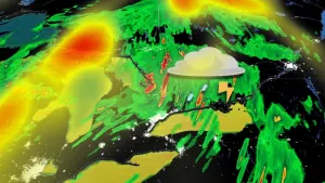
...The Flood Warning continues for the following rivers in Texas...Louisiana...Neches River at Neches River Saltwater BarrierCalcasieu River near White Oak ParkMermentau River Near MermentauSabine River Near DeweyvilleNeches River Near Evadale...The Flood Warning is cancelled for the following rivers inLouisiana...Calcasieu River Near Salt Water BarrierAdditional information is available at www.weather.gov.The next statement will be issued this evening at 1000 PM CDT.* WHAT...Minor flooding is occurring and minor flooding is forecast.* WHERE...Sabine River near Deweyville.* WHEN...Until further notice.* IMPACTS...At 25.0 feet, Lowest roads beside the river flood aroundDeweyville and subject to being closed. In addition, low-lyingroads in Southwest Beauregard Parish are flooded including RobertClark Road. Flooding occurs on the south side of Niblett BluffPark with access roads to camp houses cut off around the park.Access roads to the river in Northeastern Orange County becomeflooded.* ADDITIONAL DETAILS...- At 7:45 PM CDT Sunday the stage was 24.9 feet.- Recent Activity...The maximum river stage in the 24 hoursending at 7:45 PM CDT Sunday was 25.0 feet.- Forecast...The river is expected to remain steady above floodstage around 24.9 feet.- Flood stage is 24.0 feet.- http://www.weather.gov/safety/flood
Take extra precautions when outside. Wear lightweight and loosefitting clothing. Try to limit strenuous activities to early morningor evening. Take action when you see symptoms of heat exhaustion andheat stroke.
* WHAT...Heat index values 108 to 111 expected.* WHERE...Portions of central, south central, southwest, and westcentral Louisiana and southeast Texas.* WHEN...From noon today to 8 PM CDT this evening.* IMPACTS...Hot temperatures and high humidity may cause heatillnesses.