Weekend snow threatens 30+ CM, winter storm watches issued

It'll shortly feel like the Prairies skipped a season, jumping directly to winter this weekend in the western Prairies, including a blast of measurable snow that will put some September snowfall records in jeopardy. We take a look at the abrupt change, and why there's concern for tree damage and power outages this weekend, below.
Visit our Complete Guide to Fall 2019 for an in-depth look at the Fall Forecast, tips to plan for it and a sneak peek at the winter ahead
WEATHER HIGHLIGHTS:
Downturn in temperatures begins Thursday; sharp drop into the weekend
Snow begins late Friday, lasting through to late Sunday or early Monday
Strong winds make for blizzard conditions in extreme southern parts of Alberta and Saskatchewan
Stay on top of ALERTS in your area
WATCH BELOW: SNOW ROLLS INTO THE WESTERN PRAIRIES
For parts of the Prairies, this brewing storm has the potential to be talked about for years to come. Even the U.S. National Weather Service, which is watching its effects south of the international border, said it has the potential to become the 'new benchmark' in winter storm watches issued for parts of Montana.
Environment Canada also issued winter storm watches for parts of extreme southwestern Alberta, ahead of what is expected to be a long-duration snowfall event lasting from late Friday to early Monday morning, with hefty amounts along an area stretching from Alberta's southwest through to southern Saskatchewan.
"This may be the most snow you see through the fall, and even the winter, months through this season ahead," Weather Network meteorologist Tyler Hamilton said Wednesday evening.
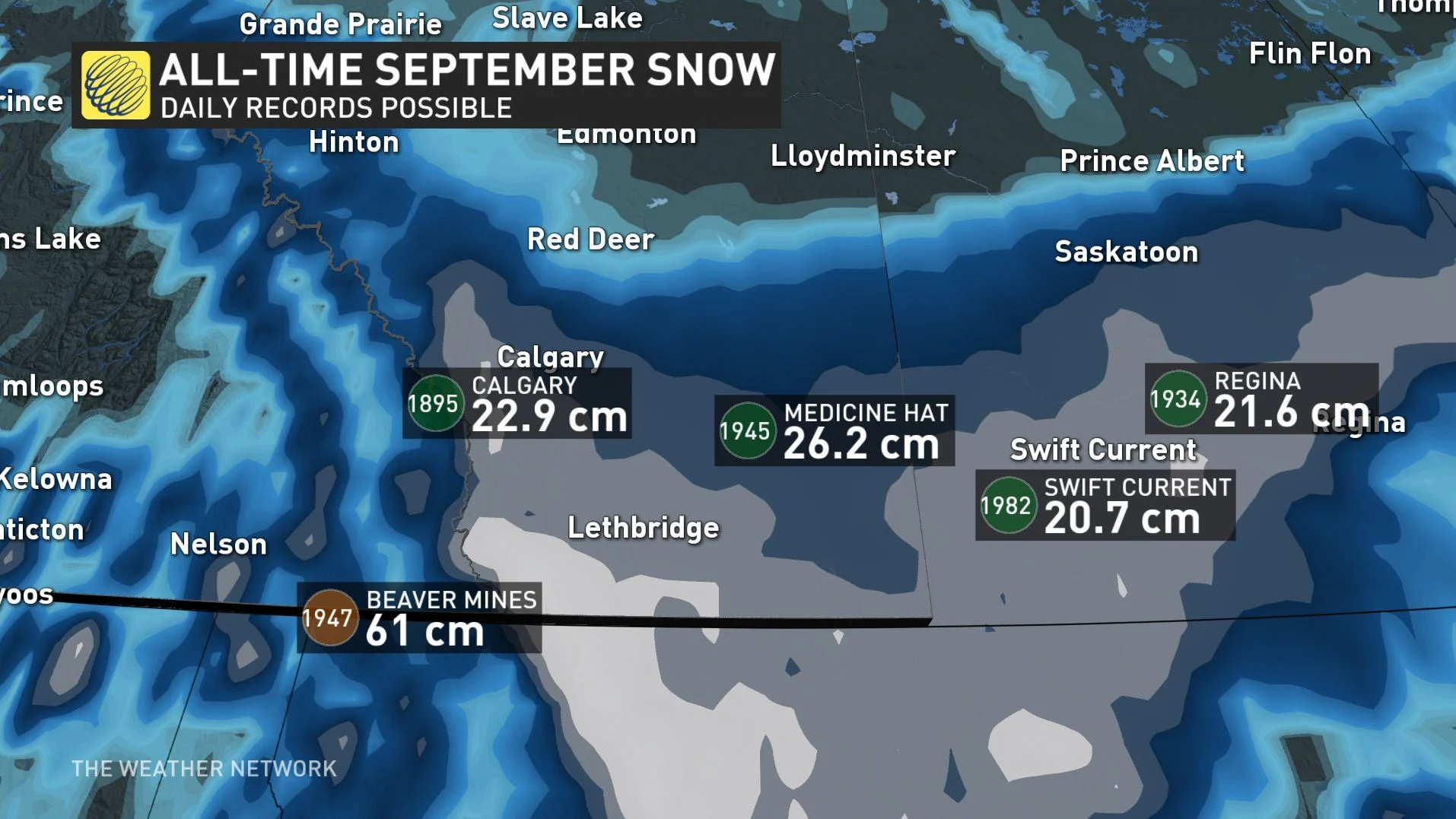
Hamilton says there are parts of the high mountains of the southwest that could see 60 hours or more of snowfall, possibly racking up as much as a metre of snow over the duration. Most places won't come near that level, but amounts of 15-30 cm aren't out of the question for the worst-hit areas.
As mentioned, those amounts are likeliest in the southwest and along extreme southern parts of Alberta and Saskatchewan, with major cities like Calgary likely seeing only light snow. Watch the video below for what some of the models are saying in terms of amounts:
Snow is not out of the ordinary at this time of the year on the Prairies, but a peculiar setup is behind these expected extreme amounts.
Late on Friday, possibly in the afternoon, the first flakes are likely to fall at the higher elevations of the mountains and foothills, courtesy of an upsloping effect -- air being forced up the mountainside to higher, colder altitudes, shedding its moisture as precipitation.
The real snowmaker will be a Colorado low -- so-named for its origins near the U.S. state of the same name -- as it moves south of the border, with its prodigious moisture precipitating as snow once it hits the cold temperatures of the region, which will have greatly declined from Thursday onward.
Hamilton says travel will not be recommended not only in the mountains, but also the most southerly parts of the region: Strong winds Saturday and Sunday, possibly gusting up to 50 km/h, will make for blizzard conditions.
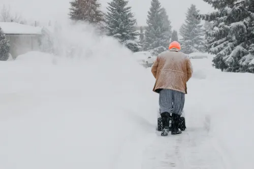
This chilly pattern and snow come with significant hardships for the fall harvest, especially across parts of southern Alberta and Saskatchewan, before the snow exits the region in the early morning hours of Monday. The strong winds and heavy snow falling on tree branches could lead to power outages as well.
However, forecasters say there's still some uncertainty in the track of the storm, so people in the region should stay alert in the leadup to it.
Stay with us here at The Weather Network for all your latest forecast updates.


